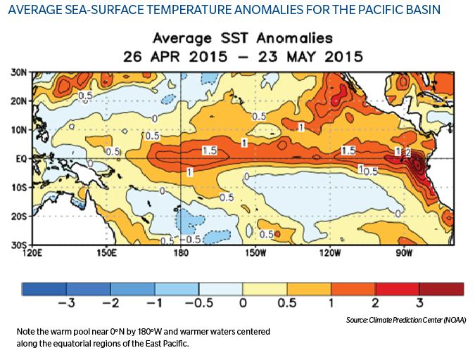
The El Niño Southern Oscillation (ENSO) phenomenon is signaled by sea-surface temperatures (SSTs) in the tropical East Pacific, with warm "El Niño" phases and cold "La Niña" phases. The large-scale circulations associated with El Niño enhance wind shear (changing wind speed with height) in the tropical Atlantic. The enhanced wind shear disrupts tropical cyclone development, generally resulting in fewer tropical cyclones in the Atlantic Basin. The suppressing effects of El Niño are found to be strongest in the deep tropics (1) and for African "Cape Verde" type storms.
According to the NOAA Climate Prediction Center (CPC), El Niño conditions are in place and there is a 90 percent chance of ongoing El Niño conditions through the upcoming season. Expectations are for a moderate El Niño.
As always there are no absolutes to hurricane predictability. The 1957 hurricane season produced three hurricanes. One of those hurricanes, Audrey, made landfall on the northern Gulf of Mexico as an impactful Category 4 hurricane. The 1965 season produced four hurricanes, with Hurricane Betsy, a Category 4 storm, making U.S. landfall on the northern Gulf. Both the 1957 and 1965 seasons were moderate El Niño years.

Note:
1. Kossin, J.P., Camargo, S.J. and Sitkowski, M., 2010: Climate Modulation of North Atlantic Hurricane Tracks. Journal of Climate, 23, 3057-3076.