
Tropical Storm Barry showed steady strengthening, eventually sitting about 115 miles south-southeast of Morgan City, Louisiana. The storm was expected to continue on a slow turn to the north over the next 24 hours or so, to move ashore over the central Louisiana coast as a probable hurricane early Saturday. Model guidance has shown somewhat better agreement in both track and intensity however considerable uncertainty still remains. Hazards of concern include excessive rainfall and storm surge to produce flooding and flash-flooding, along with some wind impacts. Interests in the area should prepare accordingly. Further details below follow the 11AM (15 UTC) update of the U.S. National Hurricane Center (NHC).
Status (11AM EDT/15 UTC NHC Advisory)
- Location: About 100 miles southwest of the Mouth of the Mississippi River
- Maximum sustained winds: 65 miles per hour
- Motion: west-northwest at 5 miles per hour
- Minimum central pressure: 998 mb
- Status: Strong tropical storm, strengthening
Discussion
- Tropical Storm Barry has shown steady strengthening in recent hours thanks to warm Gulf waters, despite dry air, wind shear, land interaction, and a highly asymmetric structure.
- Concerning track, the storm is expected by the NHC to continue on a gradual turn to the north to move ashore over the central Louisiana coast sometime Saturday morning, with some remaining spread in model track guidance.
- Concerning intensity, the storm continues to encounter modest wind shear, dry air and land interaction, but with very warm waters. Accounting for these factors, the NHC best forecast maintains slow strengthening, to make landfall as a low-end Category-1 hurricane, with some improved focus in model guidance and confidence.
Hazards of Concern
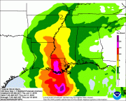
- Excessive rainfall to produce flooding and flash-flooding for affected areas. The slow forward motion of the storm together with local river systems already in flood stage will compound these effects. Rainfall amounts as high as 10-20 inches are possible per the NHC, with some localized amounts even approaching 25 inches.
- Coastal flooding due to storm surge is also a concern with inundation and velocity damage to property and infrastructure in immediate coastal areas. Water levels under storm surge could reach 3-6 feet above ground per the NHC.
- Tropical storm to hurricane force winds will render downed trees and powerlines over a widespread area along with light property damage. Damage may be more severe along and to the right of the track. Hurricane conditions are expected within warned areas tonight or tomorrow per the NHC, and tropical storm conditions are now spreading inland across warned areas.
- The NHC and local National Weather Service Offices maintain hurricane, storm surge, flood and flash-flood watches and warnings for areas under potential or immediate threat. Specifics can be found at www.nhc.noaa.gov and www.weather.gov, respectively.
Official watches and warnings, and statements from emergency management agencies supersede this update, and should be closely followed concerning matters of personal safety.
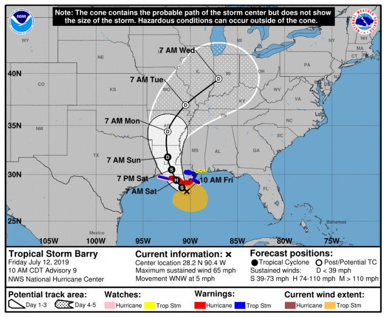
NHC Position and Best Forecast. Source: NOAA/NHC
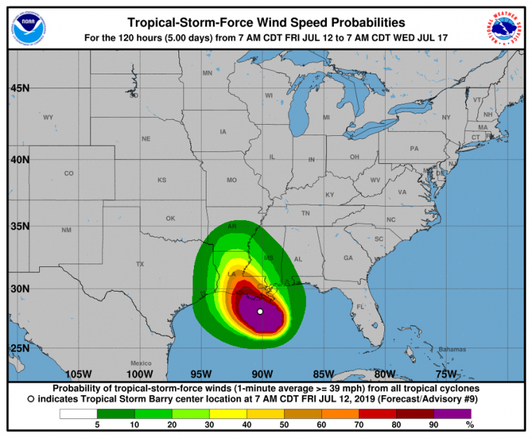
Probability of Tropical Storm Winds. Source: NOAA/NHC.
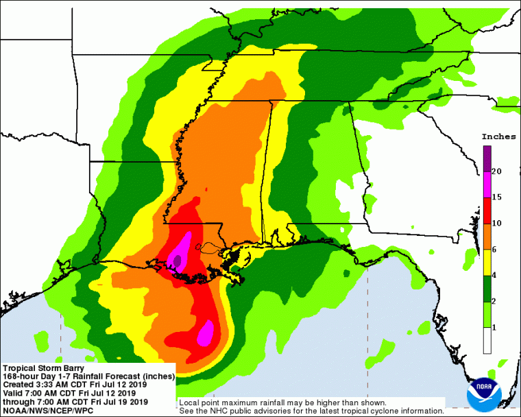
7-Day Precipitation Forecast Ending 8AM EDT (12 UTC) July 19. Source: NOAA/NHC.
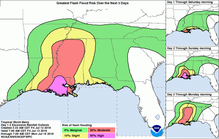
Risk of Flash Flooding – Through 8AM EDT (12 UTC) July 15. Source: NOAA/NHC.
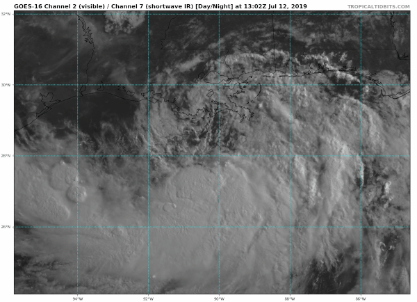
Satellite Image of Tropical Storm Barry (Shortwave IR) to 10:12AM EDT (1412 UTC). Source: Tropicaltidbits.com