

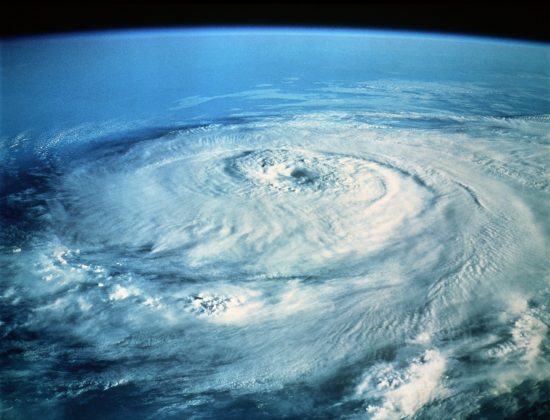
Tropical activity has escalated in recent days, with the recent development of Hurricane Hanna in the Northwestern Gulf, and Hurricane Douglas in the Central Pacific. Hurricane Hanna should make landfall on the south Texas coast later this afternoon, according to the National Hurricane Center (NHC). Landfall intensity of Hanna should be as a category-1 hurricane on the Saffir-Simpson Scale. Meanwhile in the Central Pacific, Hurricane Douglas threatens the Hawaiian Islands, and should move near or over the islands while weakening from a category-1 hurricane to a tropical storm, according to the Central Pacific Hurricane Center (CPHC).
HURRICANE HANNA Status as of 11 AM EDT (NHC)
Maximum Sustained Winds: 80 mph
Minimum Central Pressure: 978 mb
Motion: west at 7 mph
Position: about 85 miles southeast Corpus Christi, Texas
Extent of Hurricane Force Winds from Center: 25 miles
Extent of Tropical Storm Force Winds from Center: 90 miles
Discussion
- Hanna was upgraded by the NHC to hurricane status as of 8 AM EDT (12 UTC) this morning. The storm was able to intensify over very warm waters despite modest wind shear.
- The center of circulation is now on approach to the southern coast of Texas. Conditions continue to deteriorate as bands from the storm move ashore.
- The hurricane should maintain strength prior to landfall as a category-1 hurricane per the NHC. The storm should then move to the west-southwest and eventually dissipate as it encounters both land and higher topography over Mexico.
- Expected hazards include winds of a category-1 hurricane, to produce downed trees and powerlines with some property damage due to wind. Impacts will be more severe for older or sub-code structures, and also for those areas along and adjacent to the core of the hurricane.
- A storm surge of up to 3-5 feet can also be expected, to produce seawater inundation of affected properties and infrastructure along the coast and adjacent waterways.
- The hurricane should also produce general rainfall amounts of 6-12 inches with isolated amounts to 18 inches, with resulting inland flood effects. Unlike Hurricane Harvey (2017), Hanna is expected to maintain forward motion as it moves inland per the NHC, leaving rainfall amounts of lesser severity.
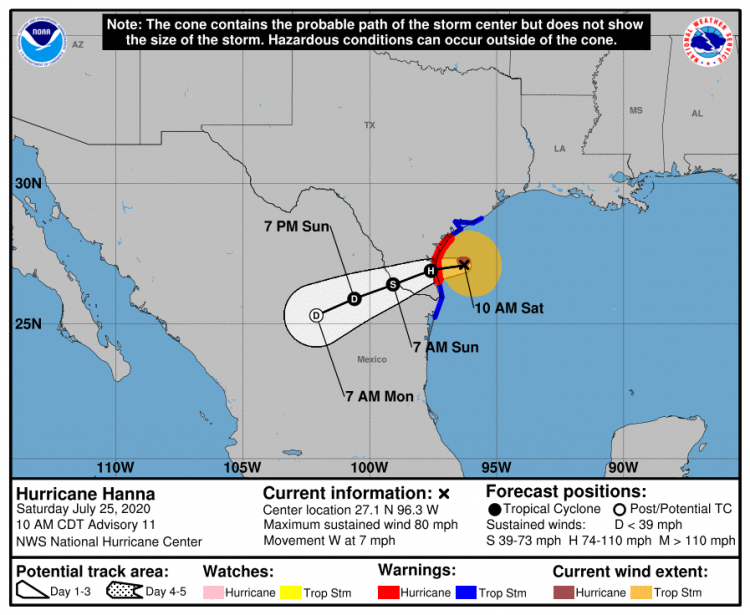
Hurricane Harvey Position and Best Forecast. Source: NOAA/NHC.
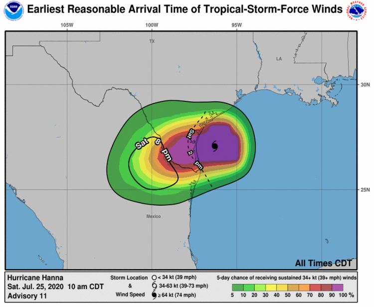
Probability of Tropical-Storm-Force Winds and Earliest Reasonable Arrival Time. Source: NOAA/NHC.
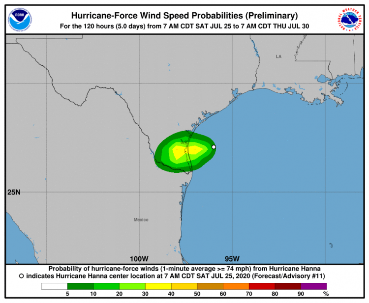
Probability of Hurricane-Force Winds. Source: NOAA/NHC.
HURRICANE DOUGLAS Status as of 11 AM EDT (CPHC)
Maximum Sustained Winds: 105 mph
Minimum Central Pressure: 975 mb
Motion: west-northwest at 18 mph
Position: about 635 miles east-southeast of Honolulu
Extent of Hurricane Force Winds from Center: 25 miles
Extent of Tropical Storm Force Winds from Center: 105 miles
Discussion
- Douglas has weakened to a category-2 hurricane since moving over colder waters.
- The hurricane is on approach to the Hawaiian Islands per the CPHC, with good agreement in model track guidance. The center of circulation should move near or over the islands tomorrow, with onset of conditions this evening for the eastern islands. Douglas should weaken from category-1 status to tropical storm status while crossing the islands.
- Expected hazards include winds of tropical storm to hurricane strength, to produce downed trees and powerlines with some property damage due to wind. Impacts will be more severe for older or sub-code structures, and also for those areas of higher elevation or near the core of the storm.
- The storm should also produce general rainfall amounts of 5-10 inches, with resulting inland flood effects.
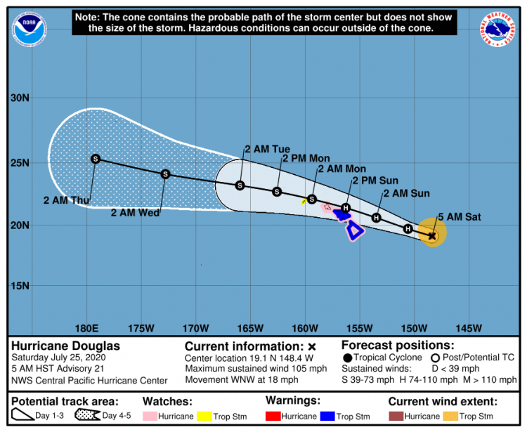
Hurricane Douglas Position and Best Forecast. Source: NOAA/CPHC.
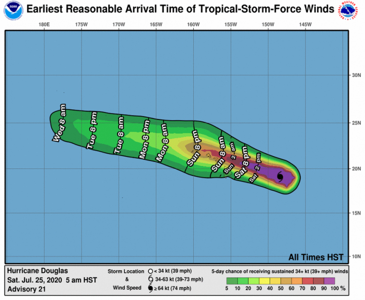
Probability of Tropical-Storm-Force Winds and Earliest Reasonable Arrival Time. Source: NOAA/CPHC
Updates and Useful Links
U.S. National Hurricane Center
U.S. Central Pacific Hurricane Center U.S. National Weather Service
Official statements from the CPHC, NHC, and U.S. National Weather Service, and those of emergency management agencies supersede this update, and should be closely monitored concerning matters of personal safety.