
Zeta made landfall over the Yucatan Peninsula overnight as a category-1 hurricane. Initial media reports indicate downed trees and powerlines with power outages, and variable property damage. Zeta is expected by the National Hurricane Center (NHC) to regain strength as a category-1 hurricane as it moves into the Gulf of Mexico today. The hurricane should approach the northern Gulf Coast Wednesday afternoon or evening as a category-1 hurricane, with onset of conditions as early as Wednesday morning. Landfall is expected between southeast Louisiana and coastal Alabama. Expected impacts include downed trees and powerlines with some property damage due to wind, with more substantial impacts along the core of the storm. Seawater inundation due to storm surge, and inland flooding due to heavy rainfall can also be expected.
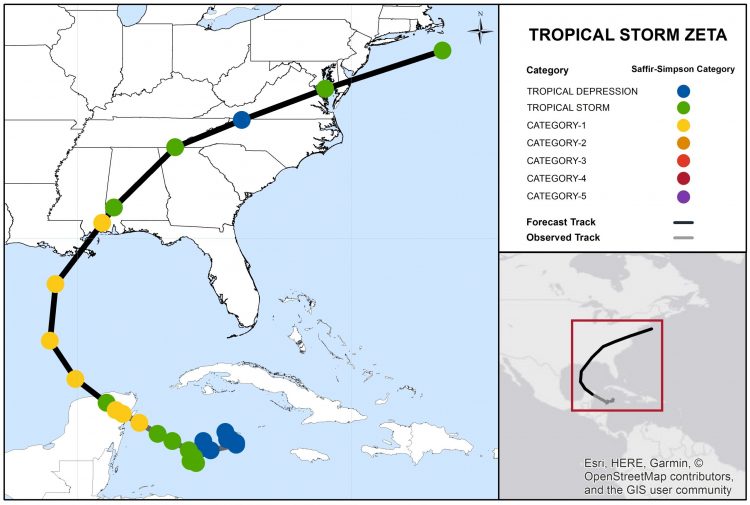
Position Reports and Forecast Track of Zeta. Source: NOAA/NHC.
Track Forecast
Zeta is expected to clear the Yucatan Peninsula and move into the Gulf of Mexico today. The features to steer Zeta include a subtropical ridge to the east, and a robust disturbance moving eastward from the southwestern US. Accounting for these factors, the NHC best forecast takes Zeta on a track to the north and then north-northeast over the next 36 hours or so. Model guidance is in good agreement on the general scenario. This should take the core of Zeta into an area from southeast Louisiana to coastal Alabama late Wednesday, with onset of conditions as early as Wednesday morning. Zeta should then accelerate to the northeast to clear the Mid-Atlantic region on Friday, possibly contributing to winter weather conditions over interior sections of the US northeast.
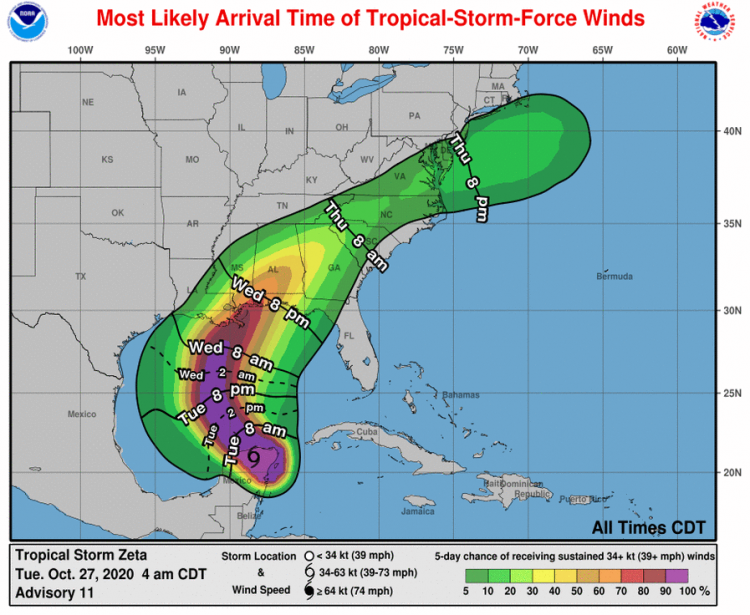
Most Likely Arrival Time (lines) and Probability (shaded) of Tropical-Storm-Force Winds. Source: NOAA/NHC.
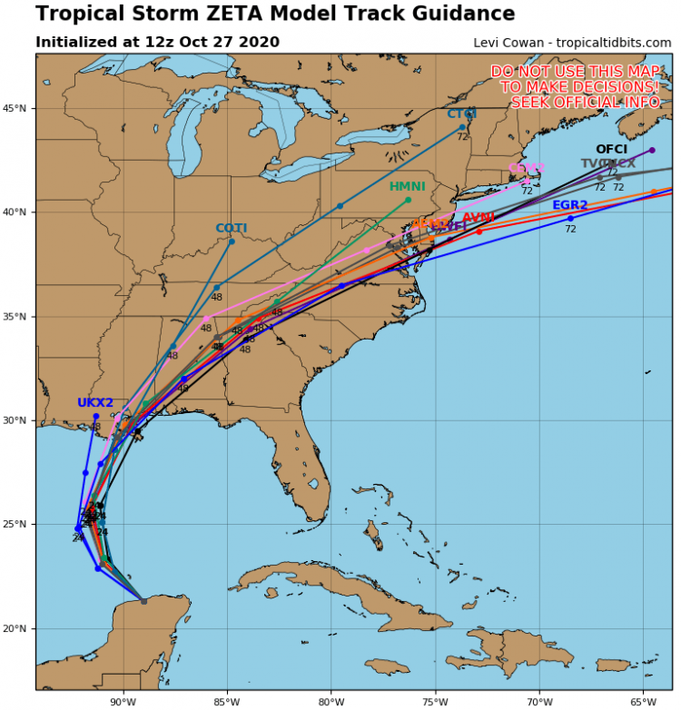
Model Forecast Track Guidance for Zeta. Source: TropicalTidbits.com.
Intensity Forecast
As Zeta clears the Yucatan Peninsula and moves into the Gulf of Mexico, it should encounter warm waters with an environment of reduced wind shear to enable strengthening. As Zeta moves into the northern Gulf waters it should encounter increasing wind shear due to the disturbance crossing the mainland, along with cooler waters, to cause intensity to either level off or perhaps weaken slightly. Accounting for these factors, the NHC best forecast is for landfall late Wednesday as a robust category-1 hurricane.
Expected Impacts
Zeta should render wind impacts of downed trees and powerlines with resulting power outages over a large area, along with some property damage. Impacts will be more severe along and adjacent to the core of the storm, or for those areas affected by tornadoes. Impacts will also include seawater inundation due to storm surge of up to 6 feet for coastal areas and adjacent waterways, with wave battering along the immediate coast. Inland flooding due to heavy rainfall is also probable for certain areas. Over the longer term, heavy rainfall with gusty winds will be an ongoing threat after landfall.
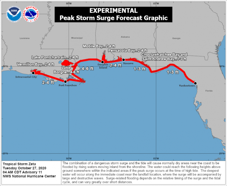
Forecast Storm Surge. Source: NOAA/NHC.
Historical Context
If Zeta makes landfall on the Continental United States as a hurricane, it will be the sixth of the 2020 North Atlantic Hurricane season, tying 1985 for the record of known hurricane landfalls since 1900.
Updates and Useful Links
Another Weather Sentinel statement is scheduled for tomorrow morning, October 28.
U.S. National Hurricane Center
Official statements from the NHC and U.S. National Weather Service, and those of emergency management agencies supersede this update, and should be closely monitored concerning matters of personal safety.