

A confluence of excessive heat and lack of precipitation has led to a dangerous wildfire situation in the western United States. As of late September, 75 percent of the western region is in a state of moderate to exceptional drought. The drought, combined with high winds and lightning activity, precipitated the ignition and rapid spread of over 70 large fires in California, Colorado, Oregon, Washington, Idaho and surrounding states. In California, fires destroyed approximately 6,500 structures, while the Oregon fires devastated five small towns. The ability to understand the underlying risk and to model potential exposures will be key to risk management and underwriting decisions moving forward, according to Alexander Van Dijk, President U.S. Branches, and Kimberly Roberts, North America Peril Advisory, Guy Carpenter.
Weather Patterns – What is Driving the Increased Frequency?
Observational data indicates that 2020 thus far is the second warmest year on record after 2016, with record-breaking temperatures in northern latitudes 3-5 degrees above average. Warm air can hold more water vapor, increasing temperatures that in turn influence catastrophe frequency and severity. In moist environments, such as the tropical Atlantic Ocean, there is an increased likelihood of extreme precipitation, as observed in the occurrences of recent hurricanes Harvey, Florence and Laura. However, in a dry environment, air attracts water vapor, and thus acts almost like a vacuum sucking moisture out of vegetation. Dry vegetation becomes ready fuel for wildfire.
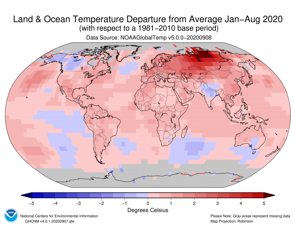
The average global land and ocean surface temperature for the first half of 2020 was nearly 2 degrees F above the 20th century average. (Source: NOAA) Link to Part II >> Link to Part III >> Link to Part IV >> Click here to register to receive email updates >>