

Tropical Storm Idalia is expected by the National Hurricane Center (NHC) to make landfall on the Florida Gulf Coast as a Major Hurricane this week. Destructive winds and storm surge together with excessive rainfall are expected. The storm continues to bring tropical storm conditions with heavy rain to portions of the Yucatan Peninsula.
Key Headlines
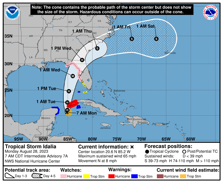
- Forecast Track for Florida Big Bend Region: Idalia is now a strong tropical storm between Cuba and the Yucatan Peninsula. After meandering for the last 24 hours or so, Idalia should begin a steady motion to the north and north-northeast as a steering flow develops between a strengthening subtropical ridge to the east, and a mid-level disturbance over the central Gulf of Mexico. A passing weather system over the continent should accelerate this motion to the northeast into Wednesday. Model guidance is in rough agreement on this scenario, and accounting for these factors the NHC best forecast is for landfall somewhere on the Florida Gulf Coast on Wednesday, with onset of conditions on Tuesday. The exact landfall area carries some uncertainty given the expected track alignment with the coast; even a slight shift in the track will make a considerable difference in the landfall point. Regardless, Idalia will render conditions of a major hurricane extending well away from the center of circulation.
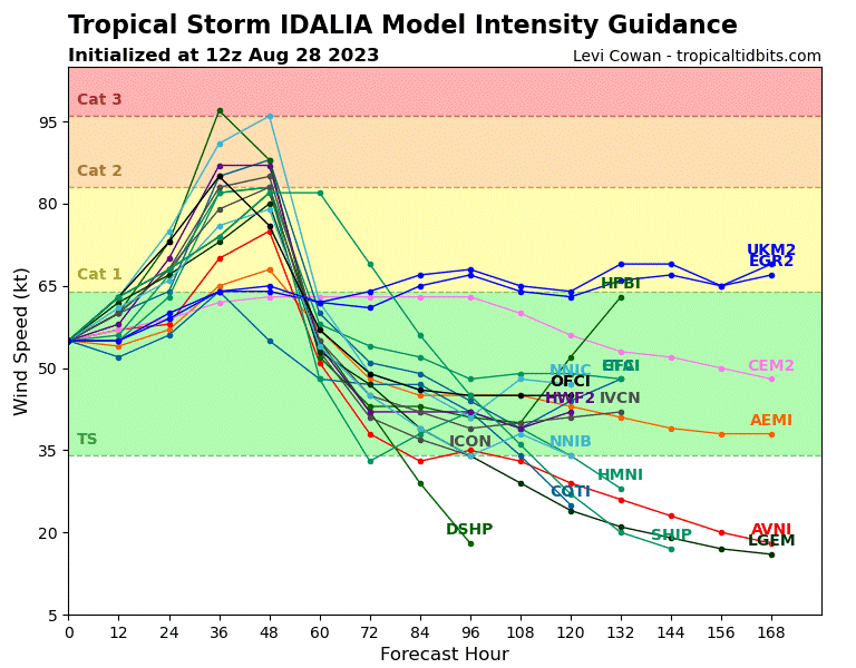
- Major Hurricane Landfall Expected: Idalia is now a strong tropical storm after an upgrade to tropical storm status last night by the NHC. As Idalia moves into the Gulf of Mexico it will encounter very warm waters extending deep (known as high oceanic heat content) which will enable strengthening. In the meantime the storm is encountering moderate wind shear which is disrupting the circulation and slowing development, and this is expected by the NHC to continue for the next 24 hours or so. The environment should then change as a disturbance from the continent brings upper-level mechanics that could enhance the development of the storm. Model guidance shows a range of possibilities but rapid intensification (a gain of 35 mph in 24 hours or less) is an increasingly possible scenario. Accounting for these factors, the NHC best forecast brings Idalia to major hurricane status prior to landfall on the Big Bend Region of Florida.
- Impacts due to Wind, Surge and Rainfall: Idalia is currently bringing tropical storm conditions and heavy rain to portions of the Yucatan Peninsula. Hurricane, Tropical Storm and Storm Surge watches and warnings are active for areas under threat - specifics can be found at www.nhc.noaa.gov.
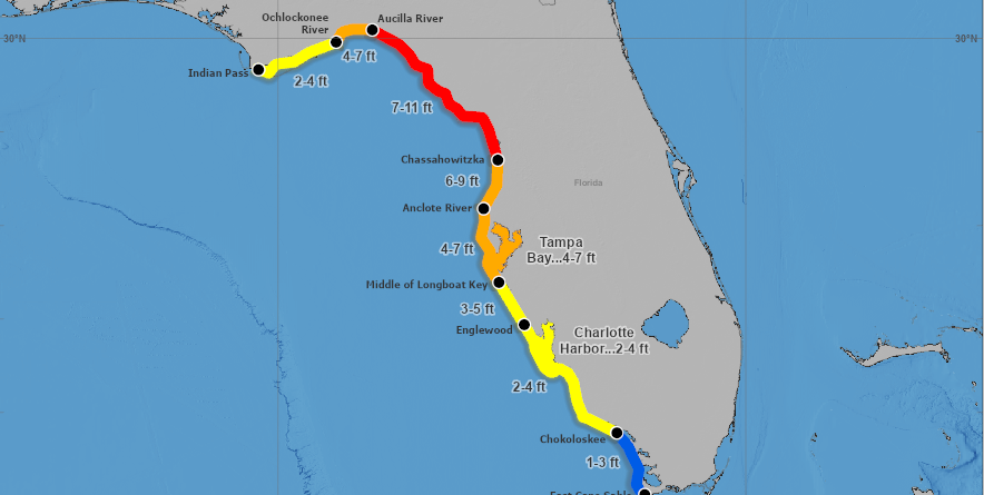
Storm Surge: A significant storm surge is expected. Seawater inundation as high as 7-11 feet above ground is forecast for portions of the Florida Big Bend region, with levels of 4-7 feet for Tampa Bay. The surge envelope is expected to extend from near Indian Pass to the Florida Keys. These estimates will change as the situation evolves. The storm surge will bring damage to structures along the coast and connected waterways due to inundation and water velocity, with more severe impacts along the immediate coast due to wave battering.
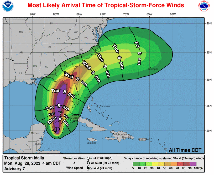
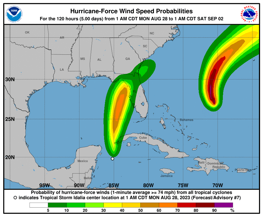
Wind: Idalia should bring major hurricane wind conditions to the Florida Gulf Coast and adjacent inland regions. Modest wind damage can be expected for affected structures meeting more recent building codes, with more substantial damage for older or less-resilient structures. Impacts will extend well away from the center of circulation to affect much of the Florida Peninsula, with the most severe effects along and to the right of the track. Tropical storm wind impacts will likely affect portions of Georgia and the Carolinas. Downed trees and powerlines can be expected over a widespread area.
Inland Flooding: Heavy rainfall amounts of 4-8 inches, with higher amounts to 12 inches are possible for portions of Florida, Georgia and the Carolinas through Thursday. This will bring the threat of inland flooding for affected areas.

Additional links of interest:
U.S. National Hurricane Center
U.S. National Weather Service
NWS Tampa
Statements from official forecast and emergency management agencies supersede this update, and should be closely followed concerning matters of personal safety.