Seasonal Outlook: US Winter 25/26 Recap & Start to SCS Season
Key Headlines
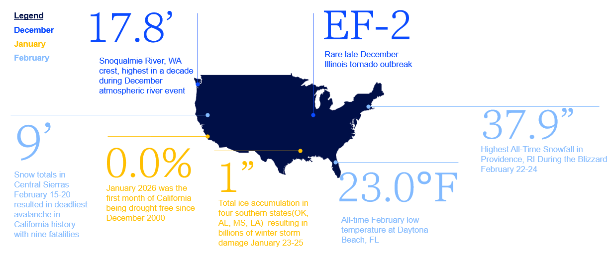
- While the United States had a top five warm and dry winter, impactful weather events were seen including the late January ice storm in the south-central US and historic snowstorms in the Northeast US and Upper Great Lakes.
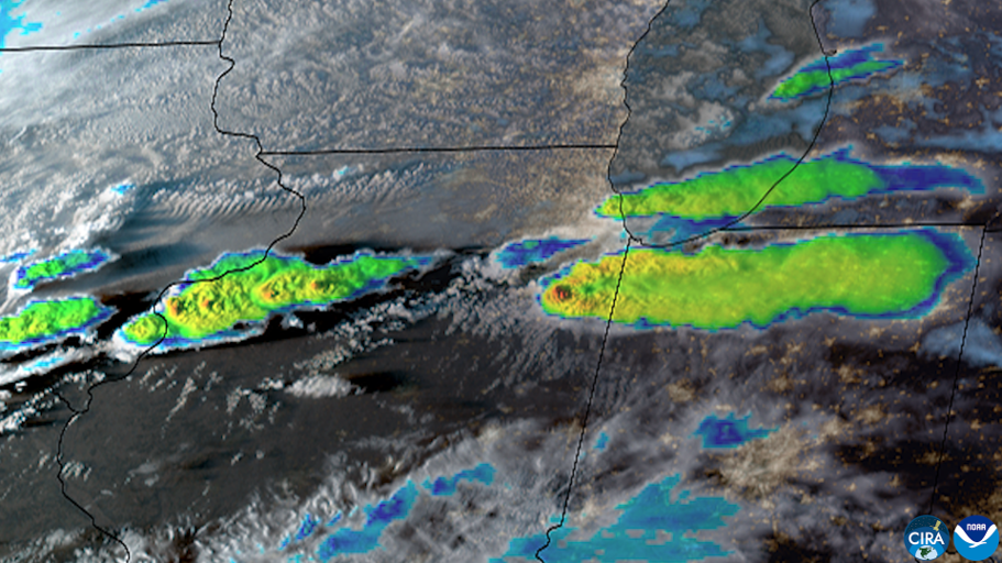
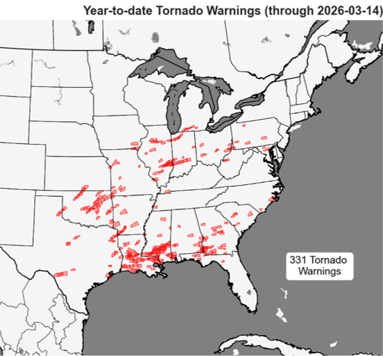
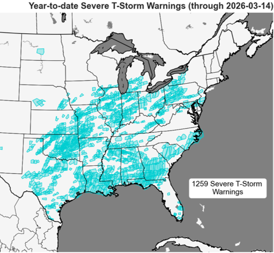
- The first half of March has featured several highly impactful Severe Convective Storm events. Two outbreaks in the middle of the month featured the largest hailstone on record east of the Mississippi River, multiple EF-3+ tornadoes and wind/hail impacts to major population centers including Texas, Oklahoma, Kansas City, Chicago, Ohio and the northeastern US.
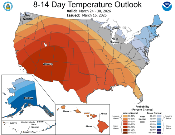
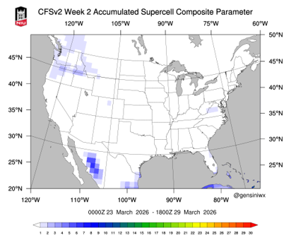
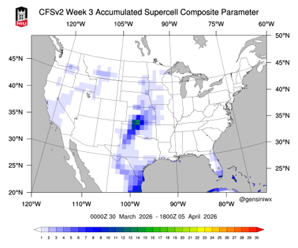
- The second half of March switches to a quiet weather pattern for severe weather while record heat will dominate a wide expanse of the western United States. The next window for appreciable severe thunderstorm activity is expected at month’s end into the first third of April.
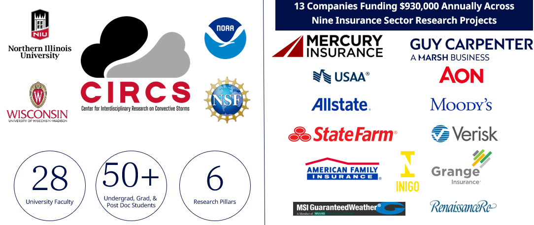
- Alongside 12 other industry partners, Guy Carpenter is sponsoring CIRCS, the Center for Interdisciplinary Research on Convective Storms. Driven by faculty and students at the University of Wisconsin and Northern Illinois University, guided by the National Science Foundation and NOAA, the center will more rapidly advance the state of Severe Convective Storm risk for the insurance sector.
Statewide Temperature and Precipitation Rank
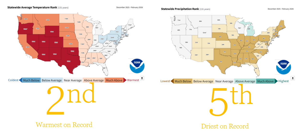
Winter Superlatives in a Top Five Warm and Dry Winter
March 2026 Severe Thunderstorm Season Starts off Like a Lion
Source: NOAA, NWS, Guy Carpenter, Center for Interdisciplinary Research on Convective Storms
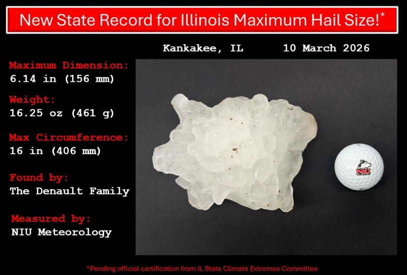
Record Largest Hailstone East of the Mississippi River
March 2026 to Go Out Like a Lamb
Record Western United States Heat Will Minimize Severe Thunderstorm Activity Until Month’s End into Early April
Year to Date Tornado & Severe Thunderstorm Warnings
Center for Interdisciplinary Research on Convective Storms
Industry / Academic / Government Collaboration to Advance Insurance Sector Severe Thunderstorm Knowledge