Key headlines
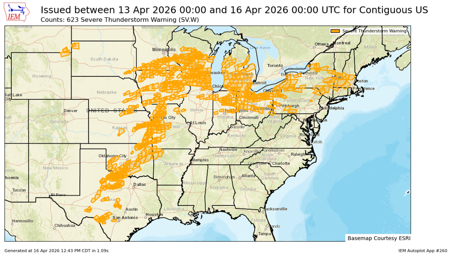
- Severe thunderstorms from April 13-15 impacted a broad corridor from the Plains into the Lower Great Lakes, with repeated rounds of activity increasing the potential for cumulative impacts across multiple states. This event will slowly move east through the weekend before ending.
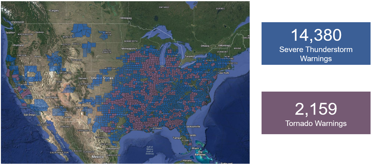
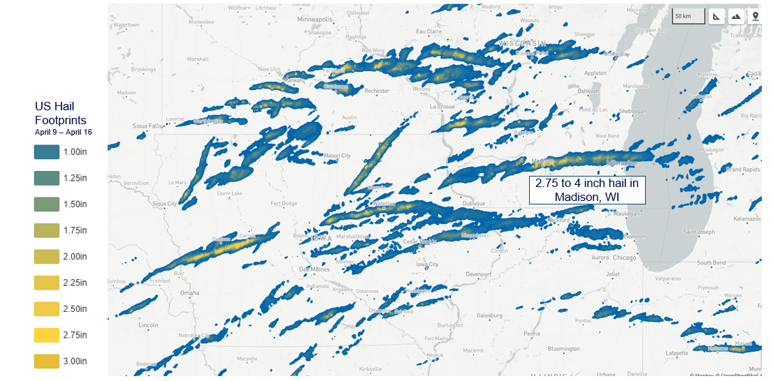
- Hail of 2 inches or greater was widespread, with localized 2.5–3.0 inch (baseball-size) and isolated ≥3 inch hail from eastern Iowa into southern Wisconsin and northern Illinois introducing pockets of elevated damage potential.
- Losses are expected to be driven largely by hail and damaging winds, with larger hail increasing the likelihood of roof replacements and higher-severity auto claims in exposed areas.
- While the pattern looks to offer a brief respite for storm activity early next week, longer range predictions suggest more heightened activity.
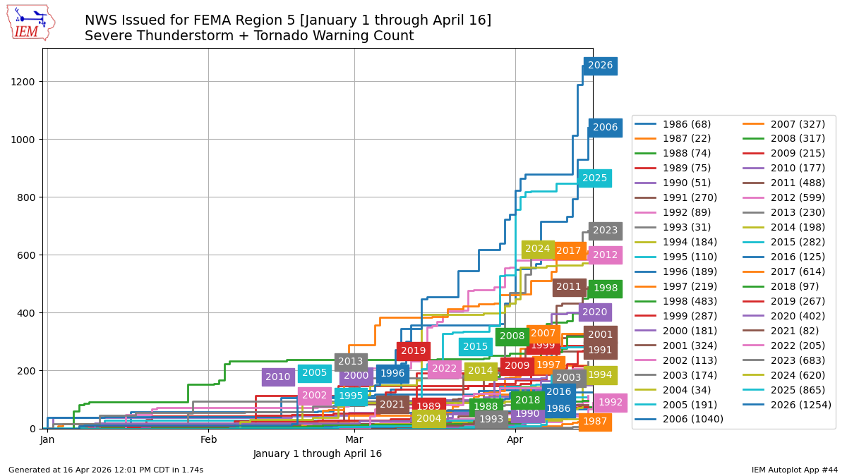
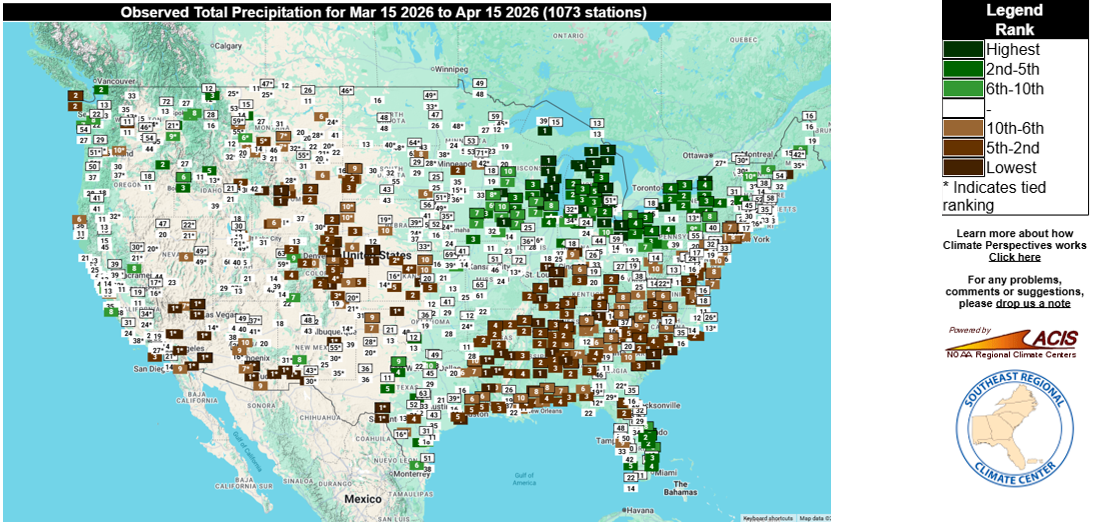
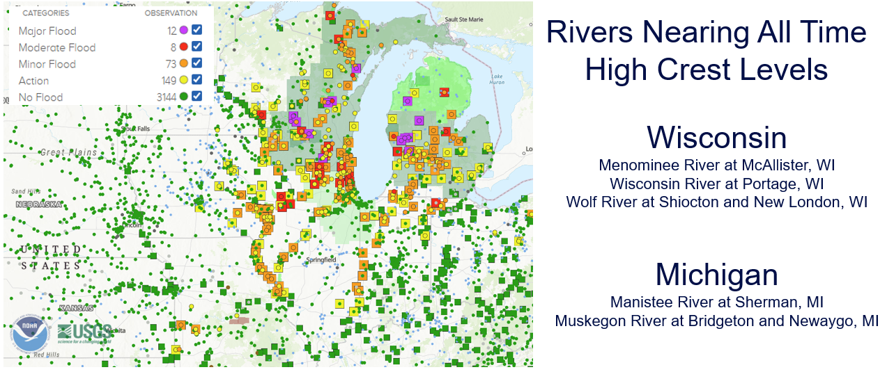
- Season-to-date, the Upper Midwest and Great Lakes region has experienced a record fast start to the thunderstorm season. Additionally, record rainfall totals over the last 30 days surrounding Lake Michigan has resulted in major flood stage reports in Wisconsin and Michigan with numerous communities experiencing basement flooding due to storm water removal systems exceeding capacity.
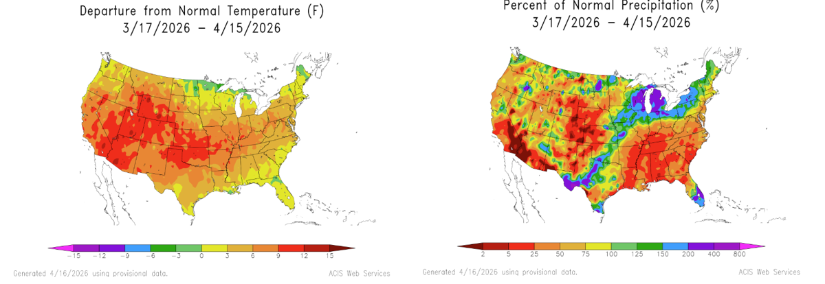
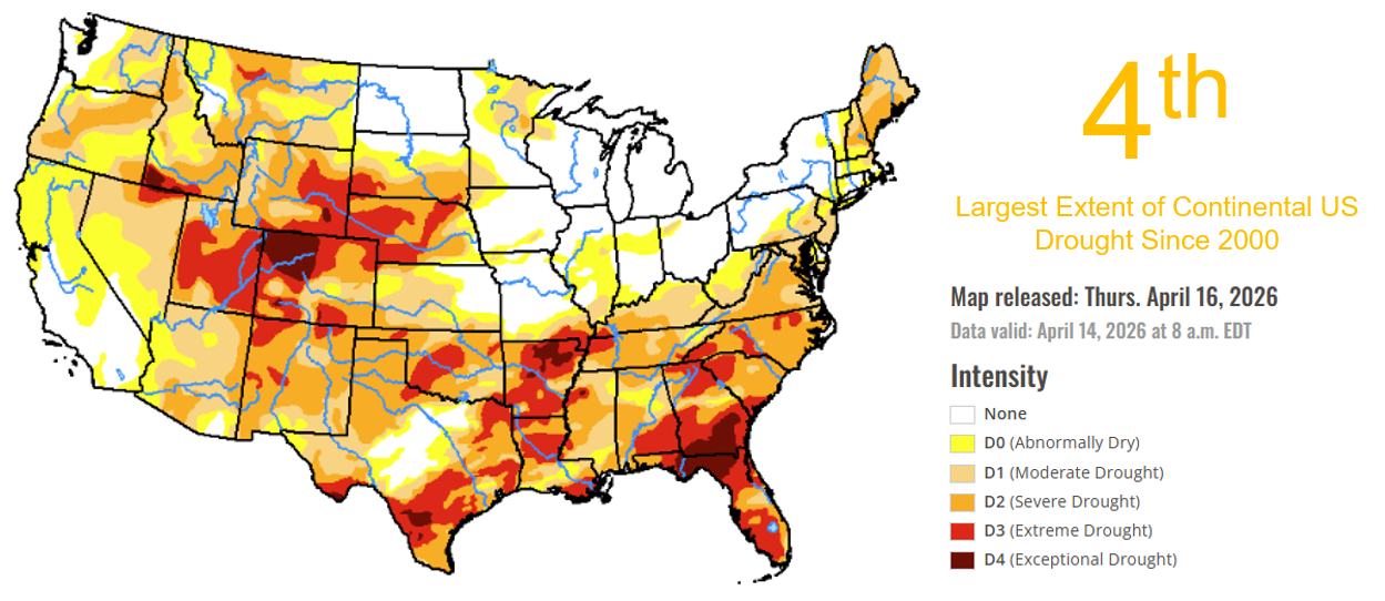
- Below activity in the Southeast US and record low rainfall the last 30 days has expanded drought in the region. On a national basis, drought extent is the fourth highest on record since 2000.
Mid-April 2026 US Severe Thunderstorm Seasonal Update
Mid-April severe thunderstorm activity
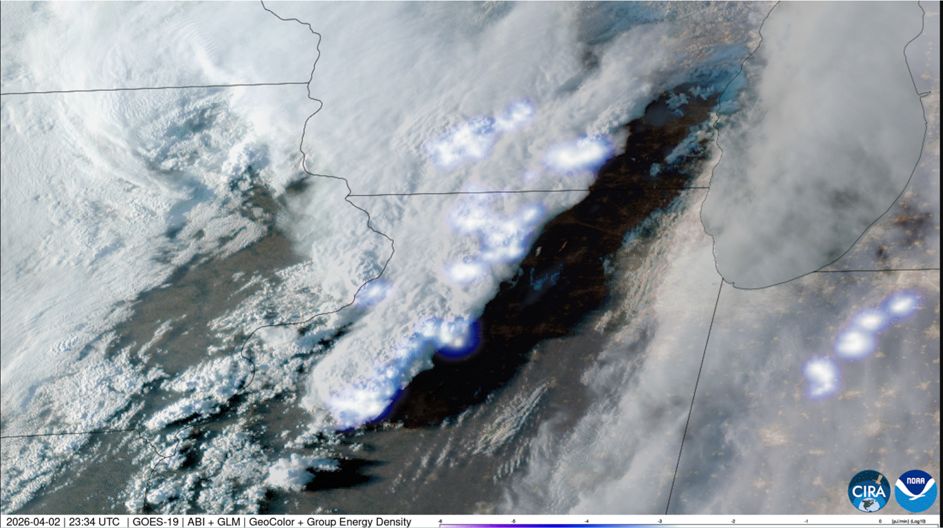
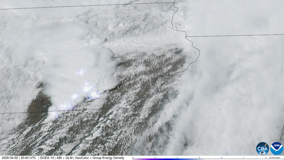
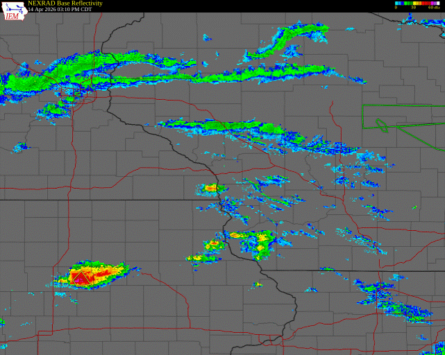
- Severe thunderstorm activity from April 13-15 impacted a broad swath of the central US, from the Plains into the Lower Great Lakes, with multiple rounds of storms producing tornadoes, large hail, and widespread damaging winds. Preliminary reports from the NOAA Storm Prediction Center, based on National Weather Service local storm reports, indicate most tornadoes were EF0–EF1, with some pockets of EF2 damage. Hail of 2 inches or greater was widespread across parts of the Upper Midwest, with localized 2.5- to 3-inch (baseball-size) hail and isolated reports exceeding 3 inches, particularly from eastern Iowa into southern Wisconsin and northern Illinois. The atmospheric setup—characterized by strong instability, robust upper-level wind shear and repeated frontal boundaries—supported both storm intensity and geographic breadth, increasing the likelihood of cumulative impacts across multiple states.
- From an insurance perspective, losses are expected to be driven primarily by hail and straight-line wind, with tornado damage more localized. The presence of ≥2.5-inch hail cores increases the likelihood of more significant property damage, including roof replacements and elevated auto losses. Early indications suggest a meaningful level of claims activity, particularly in areas with higher concentrations of exposure. This multi-day April 13-15 event sequence, combined with pockets of larger hail, highlights the potential for losses to build as claims continue to emerge and develop.
- The event continues through Saturday, April 18, with another bout of widespread severe weather anticipated as the frontal system slow moves east out of the Plains and Midwest.
Seasonal update
- While national hail and tornado reports have run close to the long-term average, wind reports are elevated so far in 2026.
- On a regional basis, a record fast start to the season has been seen in the central/upper Midwest. Additionally, record rainfall totals over the last 30 days surrounding Lake Michigan has resulted in major flood stage reports in Wisconsin and Michigan, with numerous communities experiencing basement flooding due to storm water removal systems exceeding capacity.
- Below activity in the Southeast is on account of the storm track across the northern US. Record low rainfall over the last 30 days has resulted in expanding drought in both the Southeast and Central Rockies. The extent of drought across the country is the fourth highest since 2000.
- A brief respite in severe thunderstorm activity will occur next week before activity becomes more prevalent in the last week of April into the early parts of May.