

Access the full report
Key headlines: As of August 12, 2026
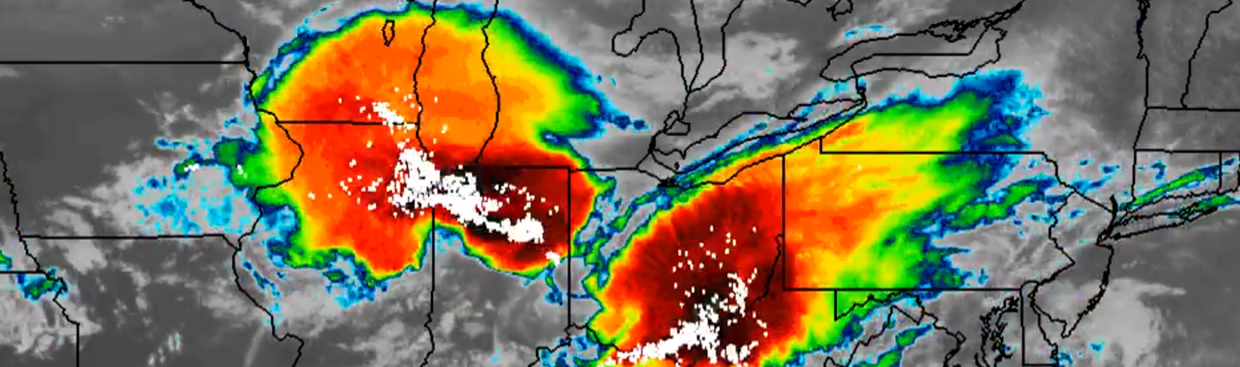
Serial wind events cause significant Midwest damage: The Midwest experienced multiple rounds of severe thunderstorm activity from August 9-11, 2026, driven by a slow-moving cold front affecting Wisconsin, Illinois, Iowa, Indiana, Ohio, and surrounding states. The strongest wind gust of 97 mph was recorded in Sugar Grove, IL, a suburb of Chicago. Multiple states reported damaging winds (60-80+ mph gusts), large hail (up to 3.5 inches), isolated tornadoes, and heavy rainfall (2-3 inches per hour with multi-day totals potentially exceeding 9 inches). Given the severity of winds in the Chicago, Indianapolis, and Columbus, OH metropolitan areas, insured losses are likely to be measured in the billions of dollars.
Structures destroyed in Western Canada wildfires: Nearly 400 structures are believed to be destroyed in British Columbia after the recent fire activity in the western part of the country. While nearly 250,000 hectares have burned in the province, this comprises less than 10% of all acreage burned in 2026. The Northwest Territories, Ontario, and Quebec have seen significantly higher acreage impacted.
M7.4 Colombia earthquake: A 7.4 magnitude earthquake struck western Colombia on Monday, August 11, 2026, with its epicenter near San José del Palmar, resulting in at least 181 deaths and initial assessment of at least 150 buildings toppled. This is the second major earthquake to strike the continent in 2026, on the heels of the June Venezuela event.
Typhoon Dolphin makes 4th China landfall of 2026: The fourth and strongest typhoon to strike China this year, Dolphin’s maximum winds at landfall were 95 mph, just shy of Category 2 status. Heavy rainfall has caused agricultural damages in China, the Philippines, and Taiwan. More than one million people were evacuated from the coastline.
Atlantic percolating, Hawaii to be impacted this weekend: The deep tropics are starting to see signs of tropical disturbances developing into several named storms. Cristobal and Dolly are the next named storms after Arthur and Bertha were short lived tropical storms in the Gulf of Mexico. At this point, wind shear associated with the strong El Niño looks to limit any strong intensification. Hawaii looks to experience tropical storm force winds with a strengthen disturbance roughly 1,000 miles to the southeast.
Elevated Europe wildfire risk declines late August: While trailing the record acreage enveloped by wildfire from 2025, enhanced threat of additional fires continues across southern Europe for the next week. North of the southern Europe heat dome, severe weather, inclusive of hailstorms, has been reported across central and eastern Europe. In the second half of August, a significant shift in the jet stream looks to bring more temperate temperatures and potential rainfall to western Europe, reducing wildfire potential.