

In the South China Sea, Higos gained strength on its final approach to the coast of Guangdong Province. The center of circulation made landfall over Zhuhai around 7 AM local time August 19 as an equivalent category-1, according to statements of the Hong Kong Observatory (HKO). Downed trees and powerlines can be expected over affected areas with some wind damage to property. Heavy rainfall amounts should also produce inland flooding. In the meantime some seawater inundation can be expected due to storm surge for immediate coastal areas and adjacent waterways, especially along and to the right of the storm track.
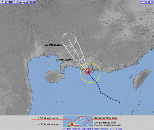
Higos track, position and best forecast. Source: JMA.
- As of 21 UTC August 18, just prior to landfall, the storm carried 10-minute sustained winds of about 100 km/hr according to the Japan Meteorological Agency (JMA), just under the threshold of a category-1.
- At the time of landfall around 23 UTC August 18, the HKO reported 10-minute sustained winds of 130 km/hr, and had reclassified the feature as a Typhoon.
- The Hong Kong Observatory (HKO) has issued a warning signal-9 for affected areas.
- The storm should begin to weaken as it moves inland on a northwesterly track.
- Wind observations per the HKO in km/hr include (10-minute sustained, gust):
- Cheung Chau: 77, 90
- Tap Mun: 70, 78
- Tate's Cairn: 65, 92
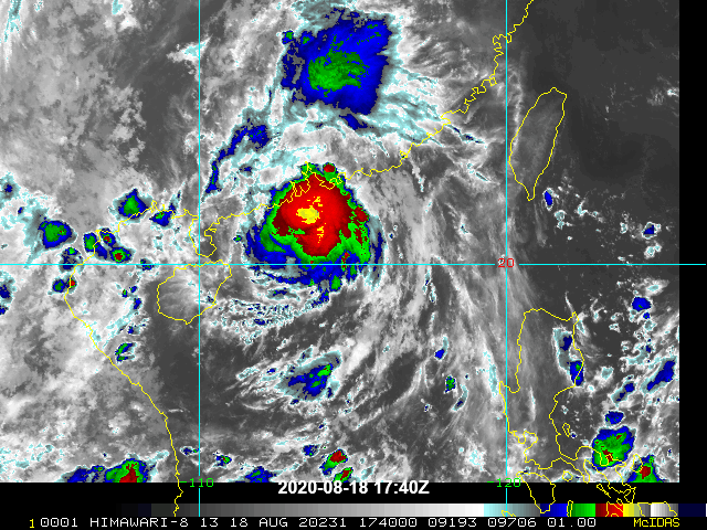
Satellite loop of Higos ending 21:30 UTC (infrared) just prior to landfall. Source: NOAA/NESDIS.
Updates and Useful Links
- Hong Kong Observatory
- Japan Meteorological Agency
- Email alerts for Weather Sentinel and CAT-i reports are available on a subscription basis at the GC Preference Center here.
- Daily, global tropical cyclone alerts are also available on a subscription basis here.
Statements from official meteorological agencies, and those of emergency management agencies supersede this update, and should be closely monitored concerning matters of personal safety.