Key Headlines
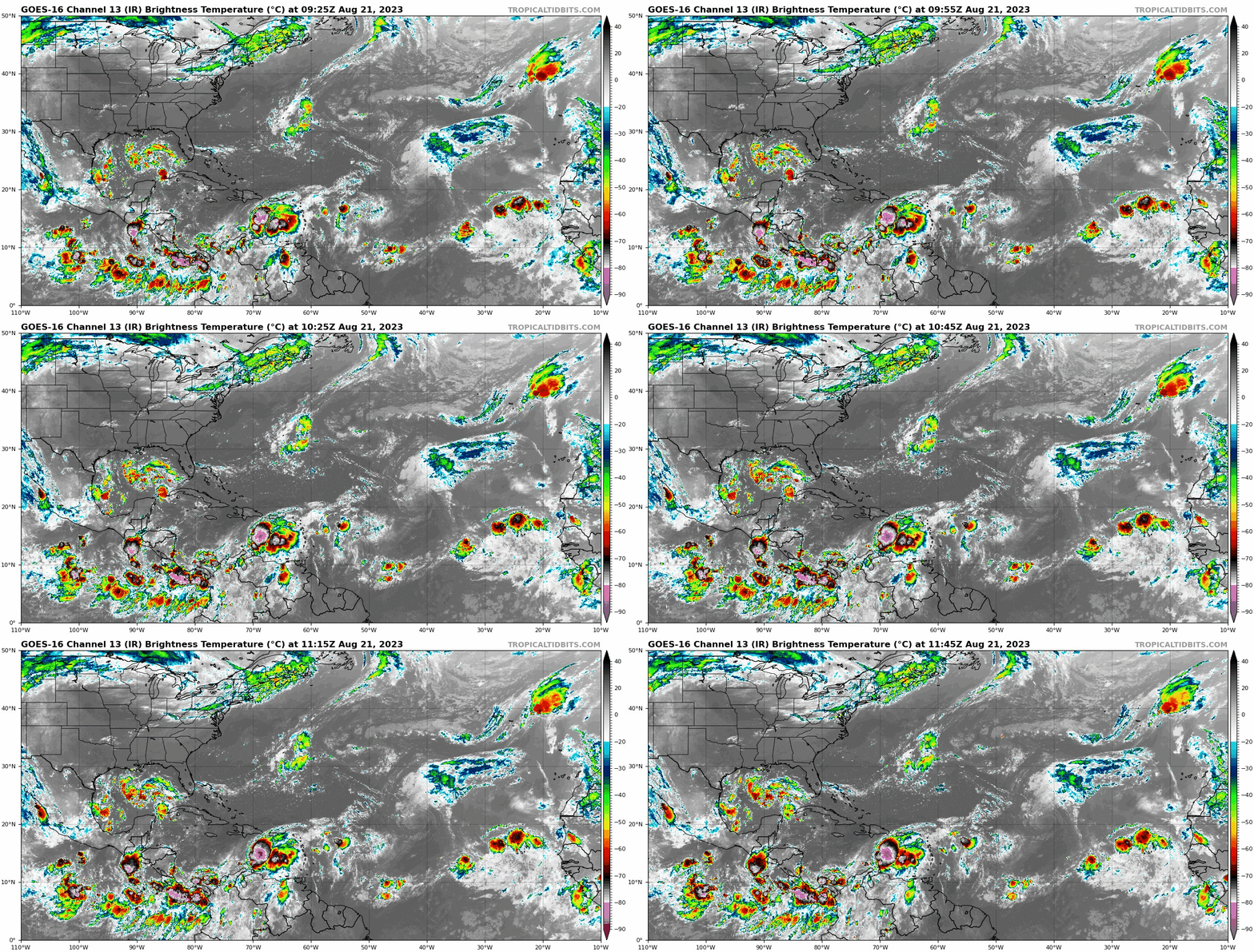
Three named storms formed over the weekend in the Atlantic with two more to potentially form this week. None of these areas of interest are expected to interact with land at hurricane strength, although two areas of interest will likely result in tropical storm landfalls early this week.
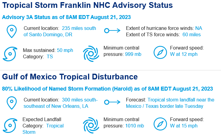
- Tropical Storm Franklin, located in the central Caribbean, is projected to turn north Monday night and cross Hispaniola as a tropical storm late Tuesday / early Wednesday. Thereafter, Franklin looks to track into the central Atlantic away from land.
- A strengthening tropical wave in the central Gulf of Mexico has an 80% chance of organizing into a tropical depression or storm (next name would be Harold). Landfall would be late Tuesday near the border of Texas and Mexico as a weak tropical storm.
- Tropical Storm Emily and Tropical Storm Gert will stay east of the Caribbean and are not projected to impact land.
- In the eastern Atlantic, a tropical wave emerged off the Africa coast this weekend. Conditions look favorable for steady strengthening, but as with Emily, Gert and Franklin, steering currents will guide this storm into the central Atlantic well away from land.
- In the East Pacific, Hilary made landfall on Baja California as a strong tropical storm. Extensive flooding across northern Mexico and the southwest United States is ongoing. A full report on Hilary will be issued early this week.
Why the recent uptick in activity?
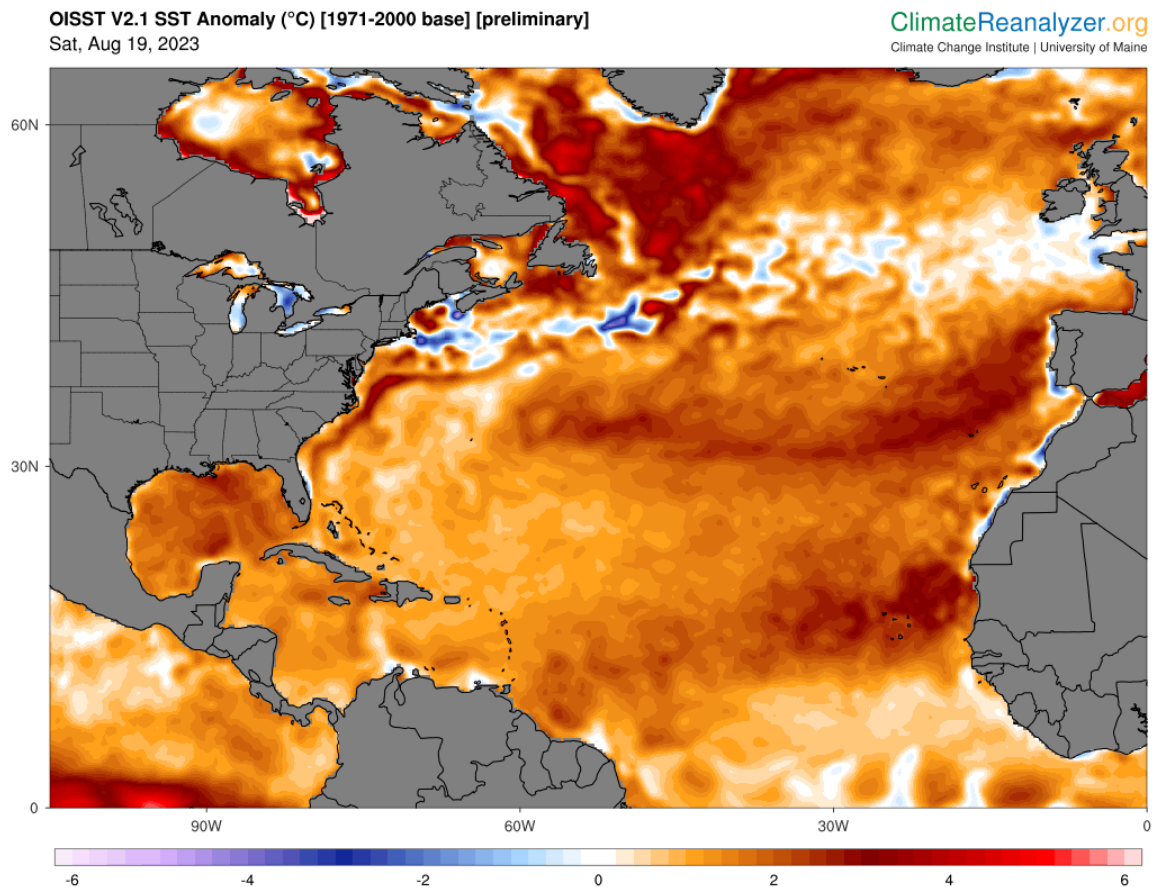
- Atlantic sea surface temperatures are at all time record warm levels and have been so for 30 days running. These conditions provide ample amounts of fuel for systems to develop if atmospheric conditions are conducive.
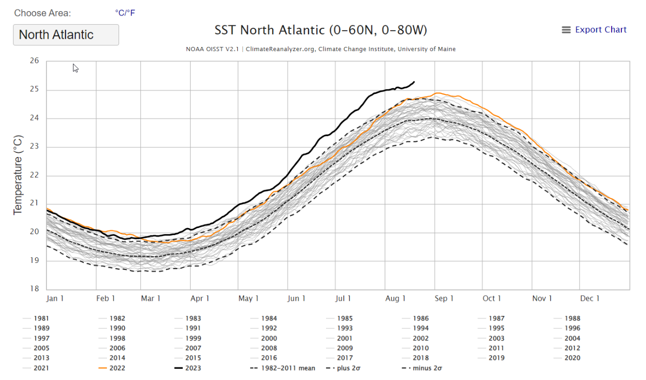
- Atmospheric patterns have moved into a favorable alignment for increased activity for at least the next several weeks. Intraseasonal influences across the tropics are currently favoring more active development across the East Pacific and Atlantic rather than other portions of the Northern Hemisphere. Hence, this period of increased activity is likely to continue into early September. This intraseasonal pattern is likely negating the influence of El Niño for the time being, reducing wind shear enough to afford opportunities for storm development and intensification.
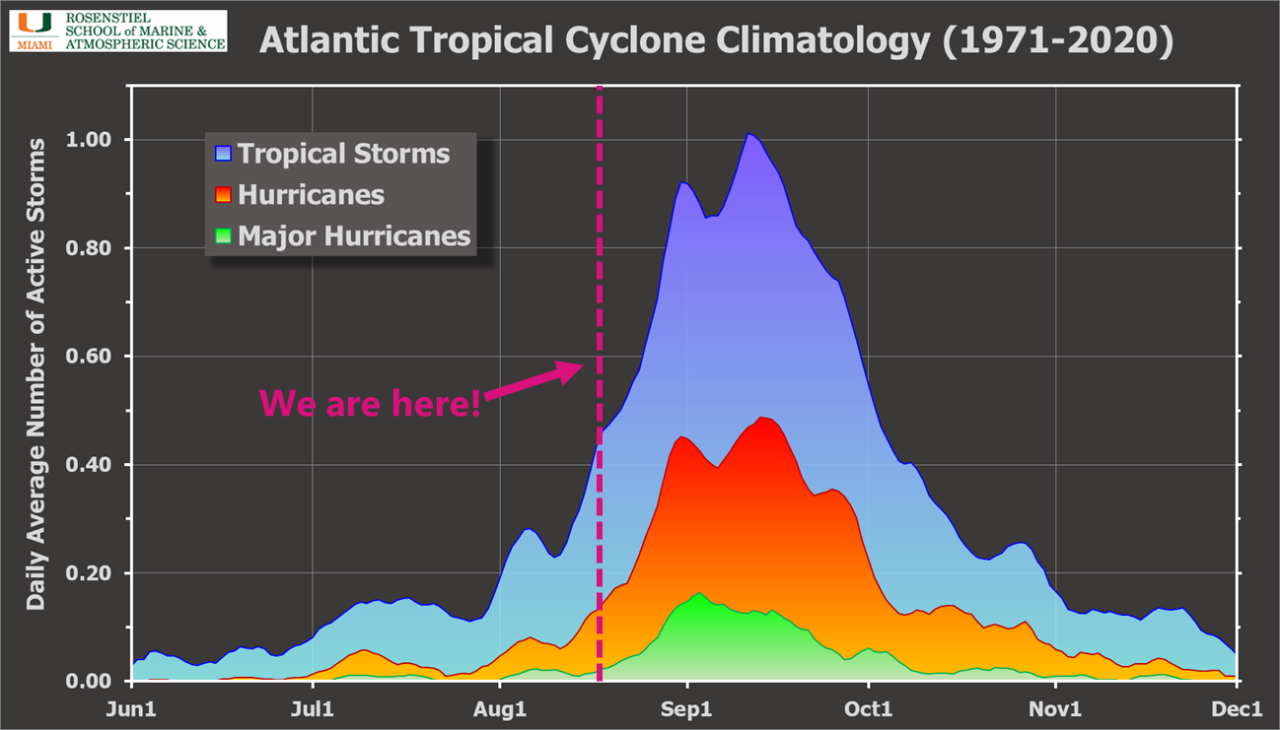
- Late August commences the most active period of the Atlantic hurricane season. Thus, increasing activity at this time of year is usually anticipated and expected.
