
 Key Headlines
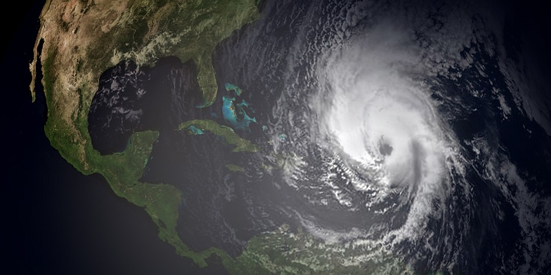
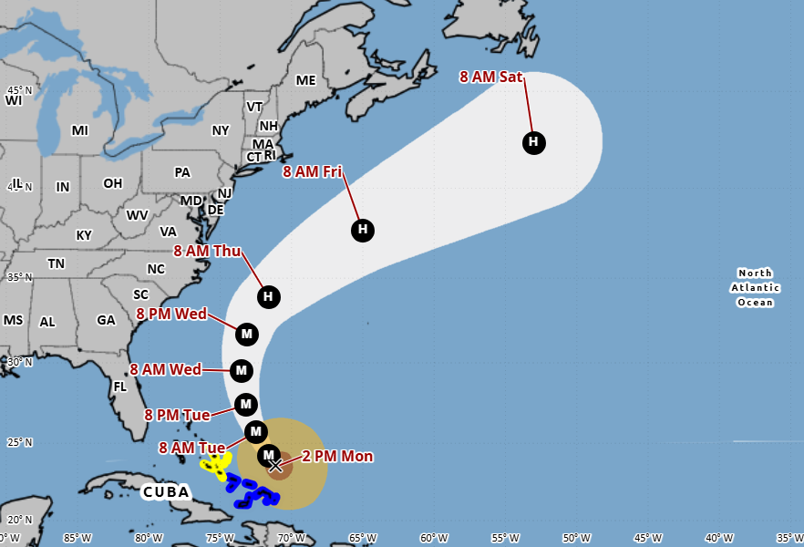
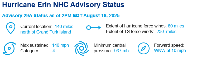
- Current Status: As of 2 p.m. Monday, August 18, the best track intensity estimate from the National Hurricane Center has Hurricane Erin as a 120 knot (140 mph) Category 4 hurricane. Erin is starting to turn northward after a slight westward wobble this morning, which is typical for large and intense tropical systems. Tropical storm conditions are possible in portions of the Bahamas and Turks and Caicos today and tomorrow.
- Weekend Recap: On Saturday morning, Erin underwent a historic, 12-hour intensification period where it increased in wind speed by approximately 65 mph and its pressure dropped by 55 mb. This is the 3rd largest wind speed increase and 3rd largest pressure drop in a 12-hour period since 1980. The storms that are ahead of Erin in the record books happened in September or later and in the Gulf/Caribbean. Hurricane Erin's intensification period on Saturday was truly unprecedented for the region and time of year.
- Outlook: Over the next 48 hours, Erin is forecasted to pass over anomalously warm ocean waters, and some additional intensification is possible. However, high wind shear should limit Erin’s ability to intensify even if the size of the storm expands. By Thursday, Erin will approach areas with cooler water and more shear, so quicker weakening is likely. The most probable track for Erin is to pass between Bermuda and the US East Coast and continue south of Atlantic Canada. The storm will continue to gain size, and there is a risk of coastal flooding between Georgia and Massachusetts until the end of the week. Depending on how close the storm approaches North Carolina, heavy rain bands may bring strong winds and flooding to the eastern part of the state. The National Hurricane Center may issue a Tropical Storm and Storm Surge Watch for North Carolina later today.
- Other North Atlantic Activity: The National Hurricane Center is currently monitoring a tropical wave producing disorganized showers and thunderstorms over the eastern tropical Atlantic. Environmental conditions appear favorable for gradual development through the week, and there is potential for a tropical storm to affect the Lesser Antilles between Friday and Sunday.
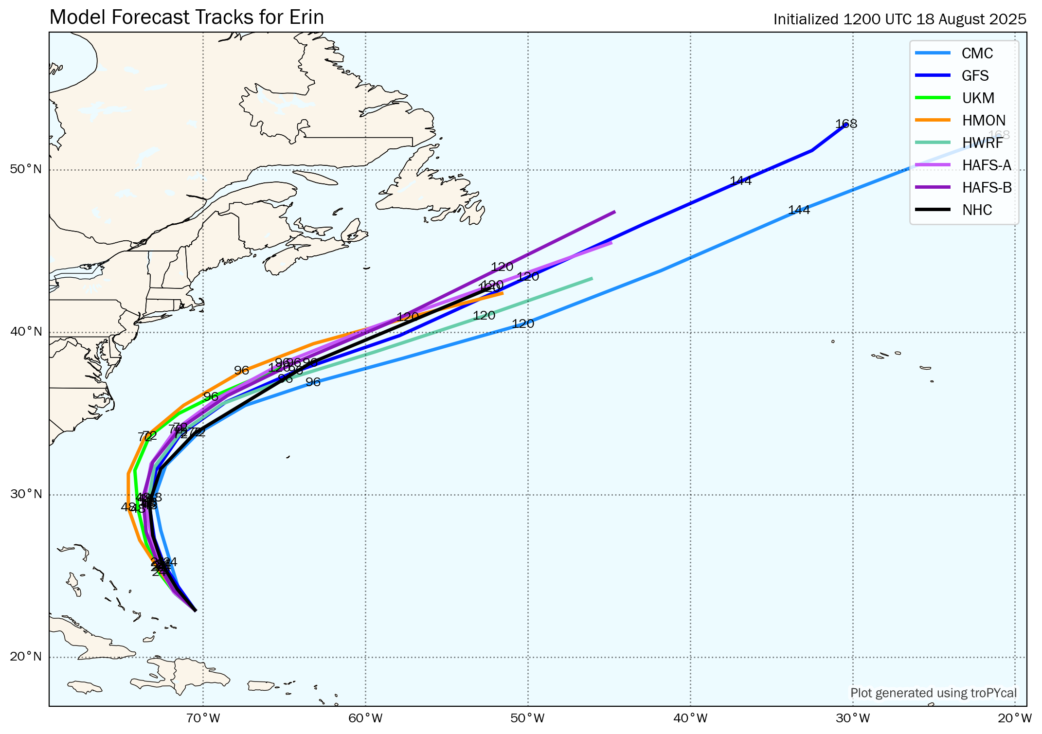
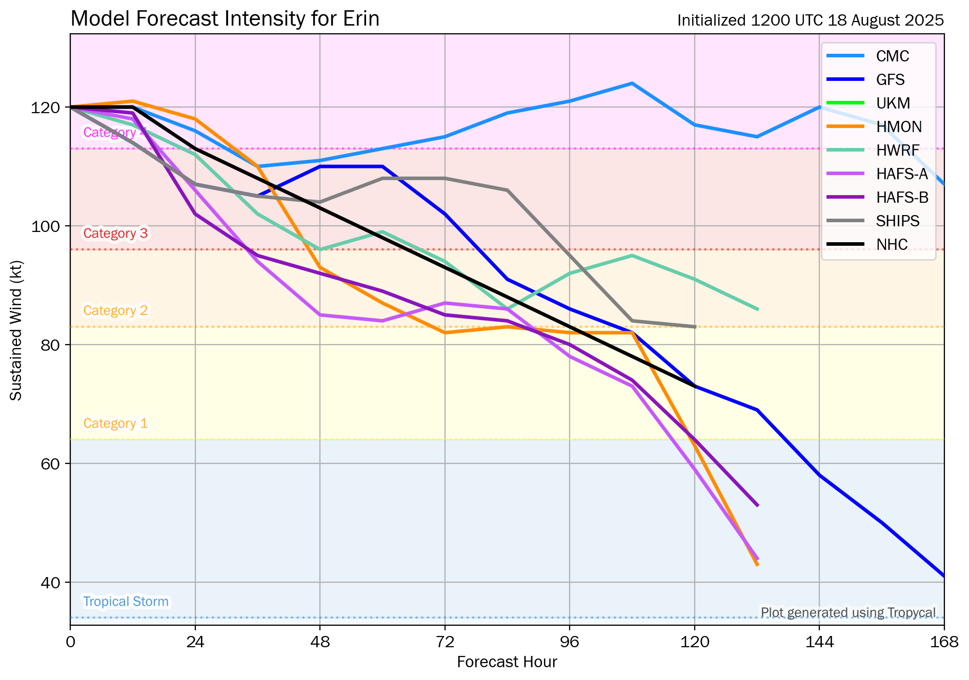 Source: Tomer Burg. 12Z August 18 5-day track and intensity forecasts for Hurricane Erin.
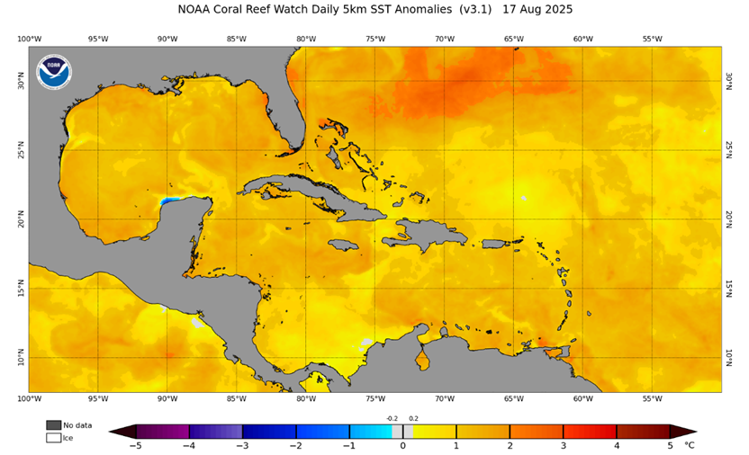
Source: The NOAA Coral Reef Watch (CRW). Daily global 5km Sea Surface Temperature (SST) Anomaly product displays the difference between August 17 SST and the long-term average (1985-2012).