Updated: September 29, 2025
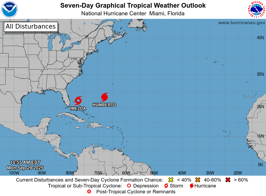

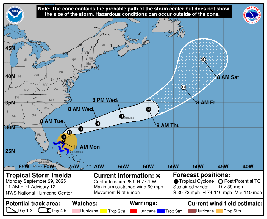
- Tropical Storm Imelda, located over the northern Bahamas, is bringing gusty winds and heavy rainfall to the region, according to the National Hurricane Center (NHC). Imelda has slowly become more organized, with sustained winds of 60 mph, and is moving northward at 9 mph. Heavy rainfall is expected across the region, with 4 to 8 inches forecast for the northwestern Bahamas.
- Imelda is forecast to turn sharply to the east on Tuesday, moving away from the US mainland. US landfall is not currently forecast by the NHC. However, significant rainfall is expected across northeast Florida, South Carolina, and southeast North Carolina.
- Current model guidance has Imelda passing over Bermuda on Wednesday to Thursday, bringing hurricane force winds and 2 to 4 inches of rain to the island. Onset of tropical storm conditions is expected by the NHC before Wednesday evening.
Live Event Report: Hurricane Humberto and Tropical Storm Imelda Update
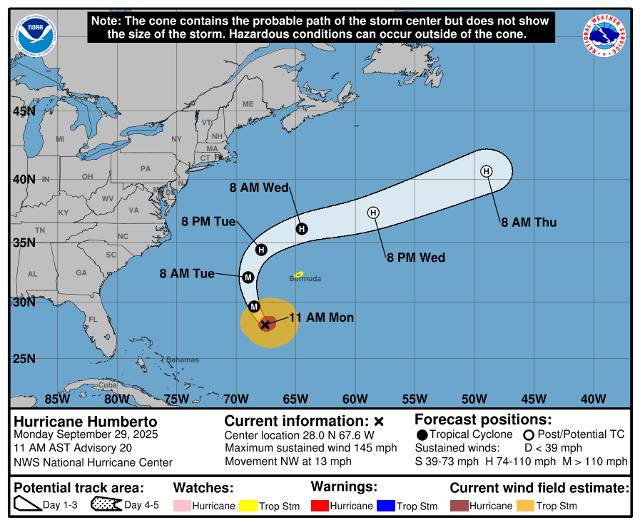
Hurricane Humberto
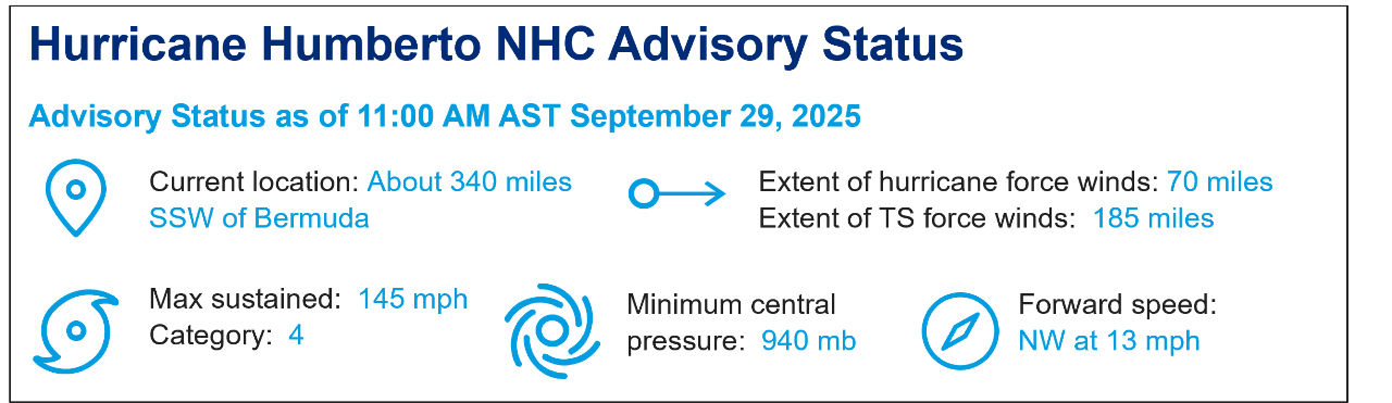
- In the Central Atlantic, Hurricane Humberto has strengthened to a category-4 hurricane with a forward speed of 13 mph to the northwest and maximum wind speeds of 145 mph. Hurricane force winds extend up to 70 miles from the center of the storm.
- Humberto is expected to continue northwards and pass along the western side of Bermuda tomorrow before curving to the east and passing along the north side of the island. A tropical storm watch has been issued for Bermuda, with tropical storm winds beginning on Tuesday and 1 to 2 inches of rain possible.