Updated September 26, 2025
Caribbean Disturbance – Emerging US Landfall Threat
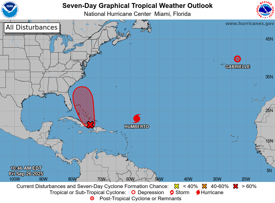
- A tropical disturbance continues to produce heavy rains and gusty winds over Hispaniola and the Turks and Caicos Islands, according to the National Hurricane Center (NHC).
- Over the coming days, this feature will likely intensify as it moves northwestward over the Bahamas and into a favorable environment for development with warm waters and reduced wind shear. The NHC is expecting an 80 percent chance that the feature will develop into Tropical Storm Imelda on Friday or Saturday.
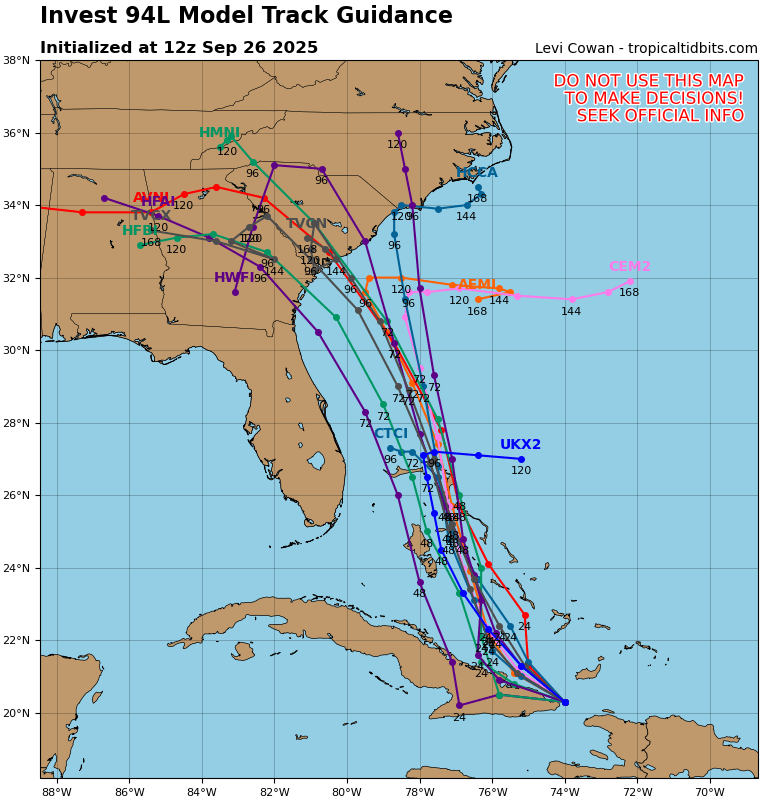
- The track forecast remains a challenge, but current model guidance suggests the storm will move north-northwest parallel to the eastern Florida coastline before making landfall near Georgia or the Carolinas early next week. Note that track uncertainty remains high due to the undeveloped nature of the feature as well as to possible interactions with Hurricane Humberto. Forecast track confidence should improve once the feature develops a closed circulation and timing of interaction with Humberto and another weather system advancing across the mainland become clear.
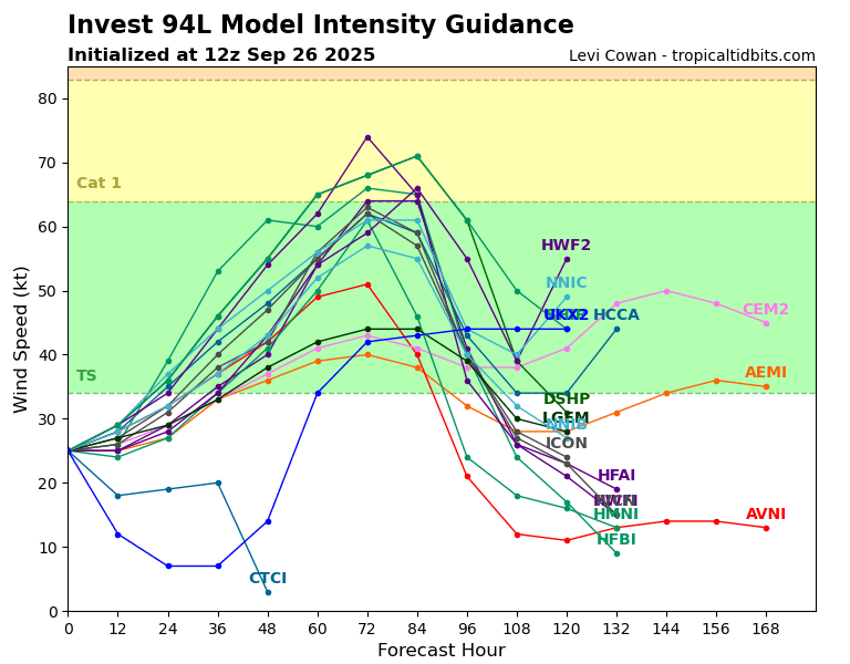
- Concerning intensity, future Imelda should begin to encounter dry air and wind shear over the longer term as it advances toward the Southeast coast, which should limit development. Weather model intensity scenarios indicate that tropical storm intensity is most probable, with a few category-1 scenarios.
Live Event Report: Future Imelda
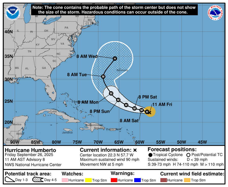
Hurricane Humberto
- In the central Atlantic, Hurricane Humberto has strengthened to a maximum wind speed of 90 mph with a northwest motion of 5 mph. Hurricane-force winds extend up to 10 miles outward from the center of the storm.
- Humberto is expected to curve northward and pass along the western side of Bermuda early/mid next week. Current model guidance suggests a low probability of Humberto making landfall on the US Mainland, although tropical storm conditions are very possible for Bermuda next week.
- If Humberto is close enough to future Imelda, its circulation could alter the track of Imelda, causing it to pull to the right, possibly reducing US impacts. Model guidance suggests that these effects would be limited, but with great uncertainty given the timing and interaction of the features involved.