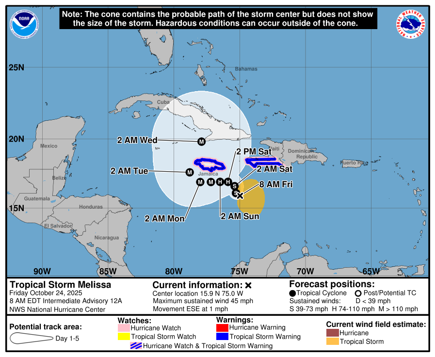
October 24, 2025
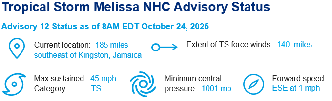
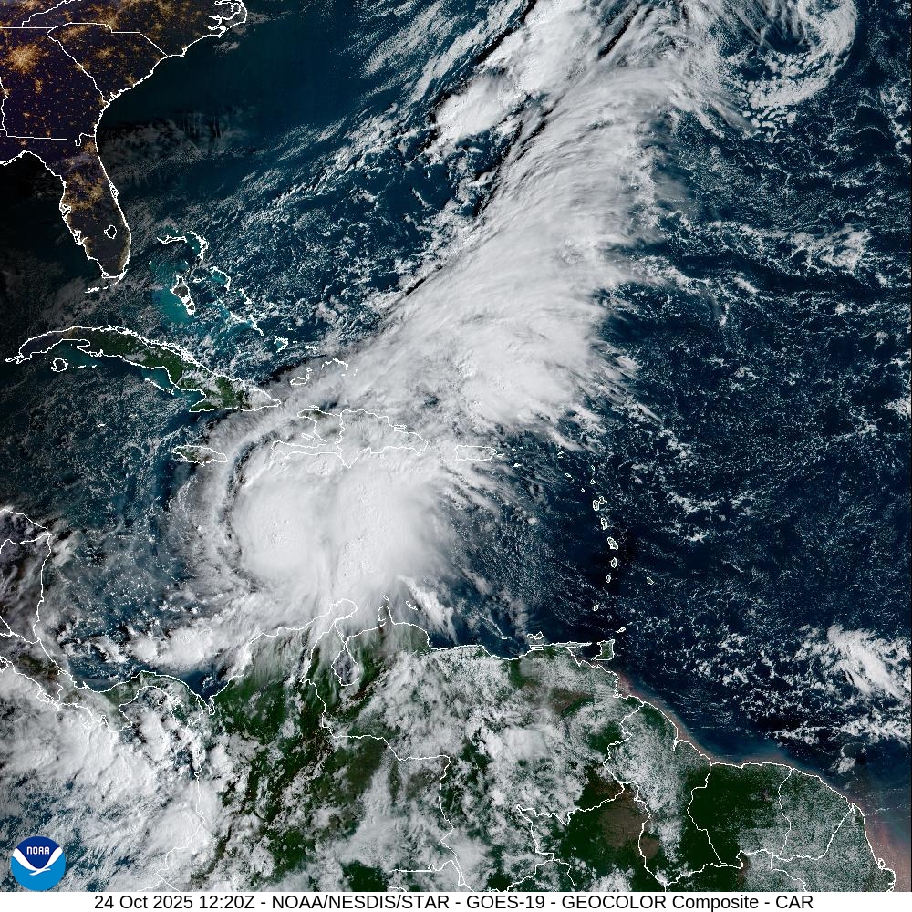
Current Conditions: At 8 a.m. EDT, the National Hurricane Center has recorded Melissa as a 45-mph tropical storm 185 miles SE of Kingston, Jamaica. Melissa remains asymmetric due to high wind shear and dry air to the west. The current estimated motion is east-south-east at 1 mph. This reversal in motion after the slow drift north yesterday has resulted in the center of Melissa staying in a 50-mile diameter circle over the last 24 hours.
Near Term Hazards: Hurricane conditions are possible in southwestern Haiti on Saturday and Jamaica beginning late Saturday or Sunday. Tropical storm conditions are expected to begin in Haiti later today and in Jamaica on Saturday.
Melissa is expected to bring 8 to 14 inches of rain to southern Dominican Republic, southern Haiti, and eastern Jamaica through Sunday night, with locally higher amounts possible. Additional heavy rainfall is likely beyond Sunday night; however, uncertainty in Melissa’s track and forward speed reduces confidence in exact totals.
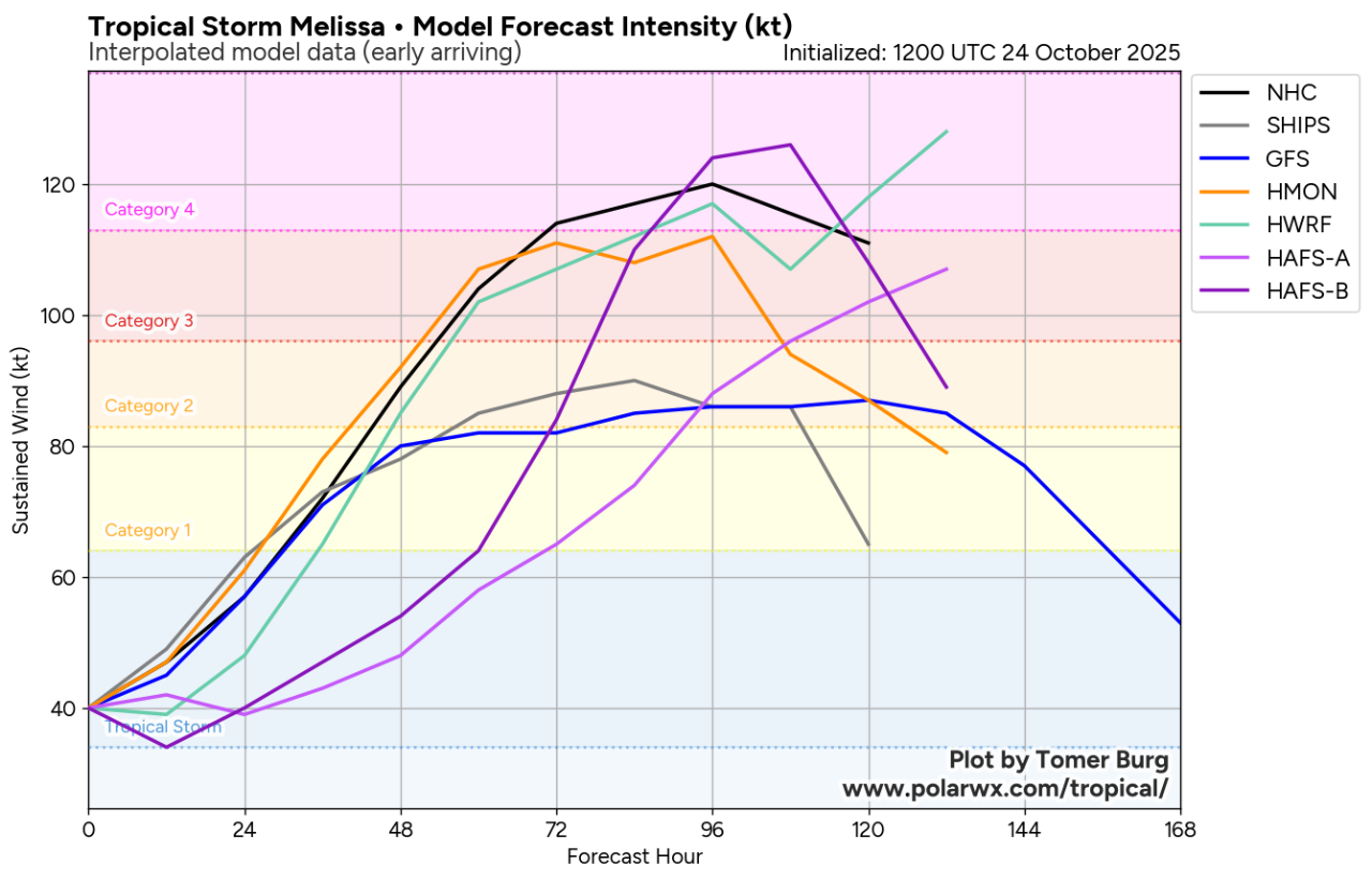
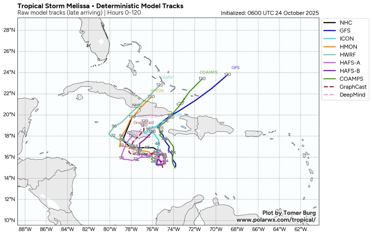
72-Hour Outlook: Melissa is forecasted to move north for 24 hours with a turn to the west expected to occur sometime around noon Saturday. Slight strengthening is projected over the next 24 hours as the storm’s alignment continues to be dislodged by high wind shear. There remains high forecast uncertainty even at these shorter forecast periods due to the challenge initializing the sheared vortex (with no clear circulation center) in the high-resolution dynamical models. Once the storm adopts a clear center, forecast uncertainty will drop appreciably (likely tomorrow afternoon).
By mid-day Saturday, shear is forecasted to subside slightly, which will allow Melissa to tap into an ideal environment with ocean heat content and sea surface temperature anomalously high for the region and time of year. Potential land interaction and high wind shear to the north are the key variables that could potentially counteract the intensification. The National Hurricane Center is forecasting a 115-mph, category 3 hurricane by Sunday evening but there is potential for a category 4+ hurricane early Monday, according to some high-resolution model guidance. A close approach or even major hurricane landfall in Jamaica by early next week is considered a plausible scenario.
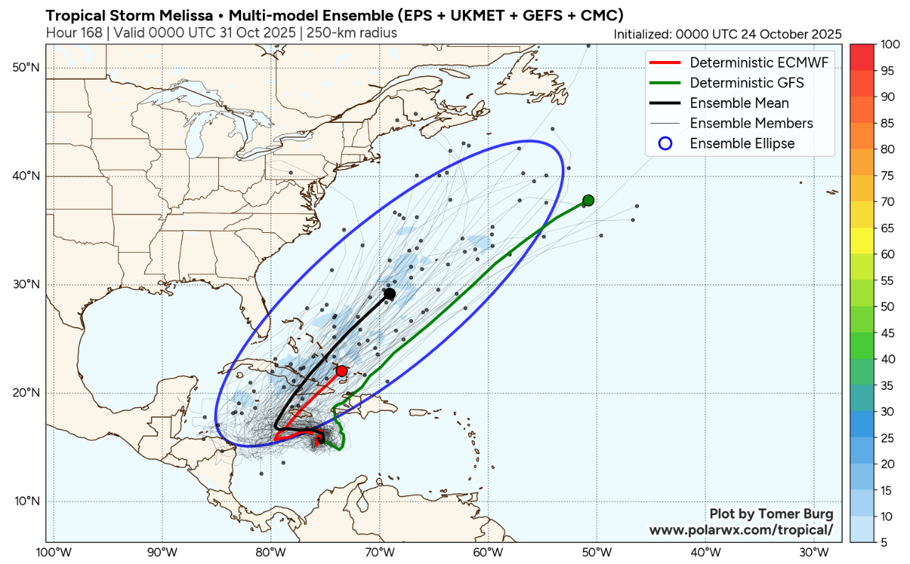
Long Range Forecast: Looking at longer forecasts from multi-model ensembles, there is potential for a sharp northeast turn toward Cuba after 72 hours, but this forecast range is more uncertain. The timing of the turn towards Cuba still has significant disagreement in the models. A few ensemble members show a more southwestward track, bringing Melissa just offshore off of Nicaragua before turning towards Cuba. At this point, almost all model guidance suggests Melissa will not affect the eastern United States. Regardless, it is still too early for any definitive statement about potential impacts to the United States or Canada.