
Setting the Stage: ENSO Outlook and Global Temperature Signals
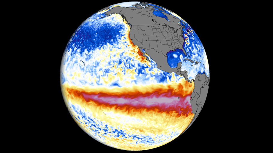
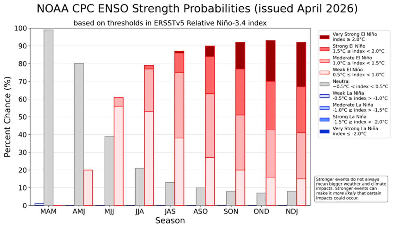
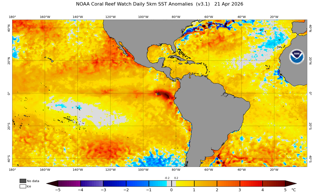
- Conditions across the tropical Pacific are currently trending toward neutral, with increasing signs of a developing El Niño. Sea surface temperatures are beginning to warm in the central and eastern Pacific, and most forecast models point toward a continued shift toward El Niño conditions through the summer and into the second half of the year. While the exact strength of the event is still uncertain, the overall direction is becoming clearer, with a warming Pacific expected to begin influencing global weather patterns in the months ahead.
- Forecast confidence during this time of year is historically limited due to the “spring predictability barrier,” however, as we move through April and into May, forecast skill typically begins to improve. While some uncertainty remains, we are now approaching the point where model agreement and physical signals become more reliable, especially for late summer and fall conditions. While the exact strength of El Niño may still evolve, the directional signal—toward a warming Pacific and associated global teleconnections—is becoming increasingly actionable.
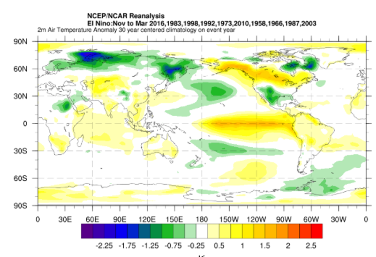
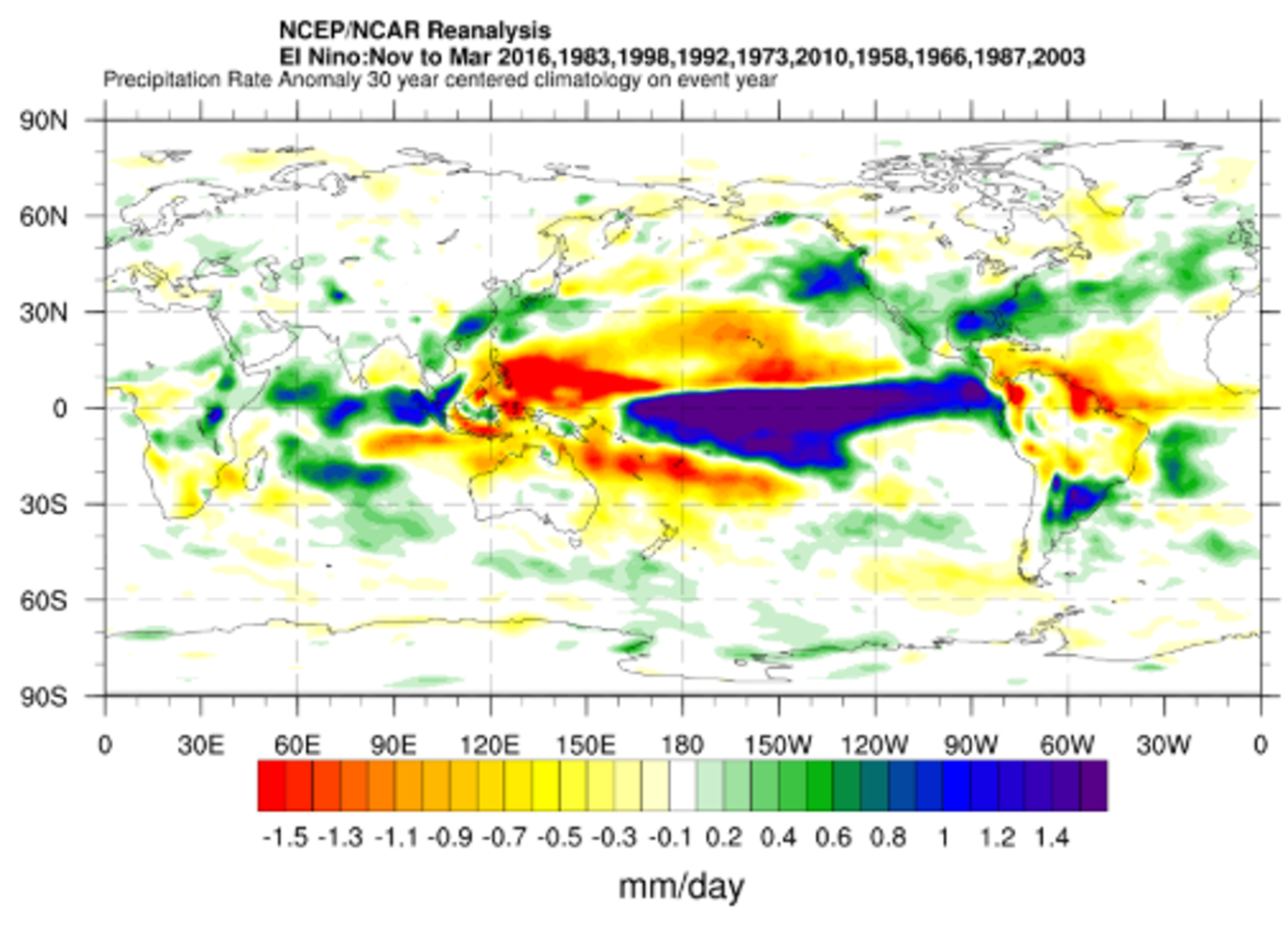
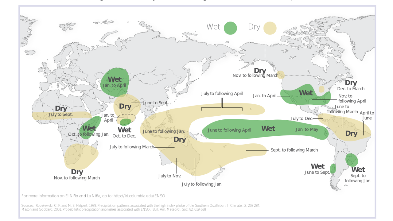
- As El Niño develops, it acts as a global redistributor of heat and precipitation. Globally, El Niño years are typically associated with elevated temperatures, while precipitation patterns shift regionally—bringing wetter conditions to parts of the Americas and drier conditions to Australia, Indonesia and portions of Southeast Asia. These changes are not uniform, often concentrating rainfall into more intense events in some regions while prolonging dry periods in others.
- These shifts in temperature and precipitation provide the foundation for how risk evolves across key perils, influencing tropical cyclone activity, flood potential, and wildfire risk in different ways across the globe.
El Niño’s Global Footprint: Implications for Cyclone, Flood and Wildfire Risk
Tropical Cyclone: Shifting Track and Activity
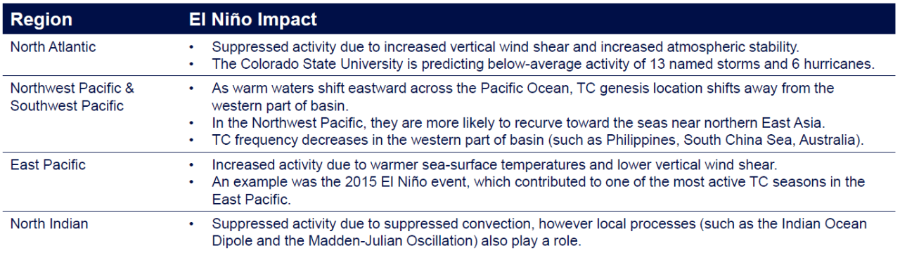
- ENSO impacts tropical cyclone (TC) tracks and activity mostly through modulations in sea-surface temperatures, trade winds and the local atmospheric circulation. High sea-surface temperatures and low vertical wind shear are conducive to TC development, and vice versa. Scientific studies have pointed to different “flavors” of ENSO, which means that each El Niño episode is unique and may lead to slightly different climate teleconnection patterns. The below table summarizes the general expectation of how El Niño impacts TC activity across different regions, due to differing changes in the local oceanic and atmospheric environment.
Flood: Redistribution of Precipitation and Hydrological Extremes
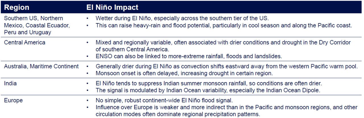
- ENSO impacts precipitation and hydrological extremes mainly through shifts in tropical convection, storm tracks, monsoon behavior and the broader atmospheric circulation, which, in turn, alter where and when heavy rainfall, runoff and, in some regions, snow- and ice-related flooding occur. During El Niño, some regions tend to become wetter and face higher flood potential, while others tend to become drier; the response is strongly region- and season-dependent. ENSO-related rainfall variability is very likely to intensify with warming. The table below summarizes typical El Niño impacts on precipitation and flood potential across different regions:
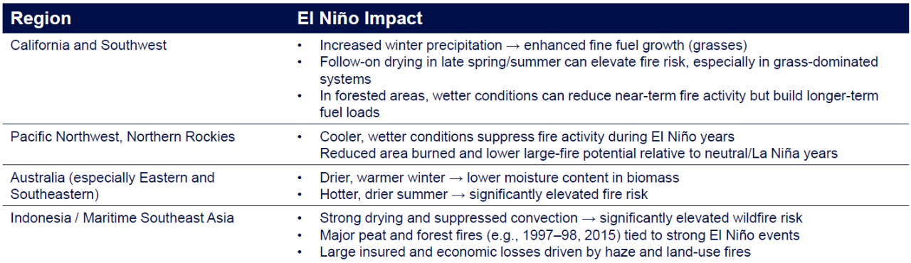
Wildfire: Timing, Drought, and Fuel-Driven Risk
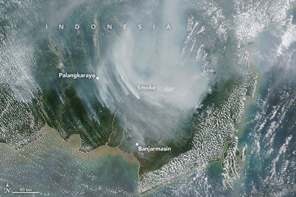
- El Niño conditions tend to redistribute wildfire risk globally by shifting precipitation and amplifying heat, with the strongest signals emerging in regions where drought aligns with the core fire season. In Australia and Indonesia, this relationship is particularly direct: El Niño typically peaks during primary fire season, driving suppressed rainfall, elevated temperatures, and earlier fuel drying. This creates a high-confidence signal for more active and prolonged fire seasons, especially in fire-prone regions of eastern Australia and across Indonesia’s peatland and forest systems. In contrast, wildfire risk in the US is influenced more indirectly. El Niño peaks in winter, outside the core US fire season, meaning impacts are often lagged and mediated through fuel dynamics—with wetter winter conditions in some regions increasing vegetation growth, which can later serve as fuel if followed by a warm, dry summer.
Insurance Implications
- From an insurance perspective, El Niño represents a redistribution of risk rather than a uniform increase or decrease in loss potential. Shifts in temperature and precipitation can alter the geographic concentration and timing of losses, with increased flood risk in some regions, heightened wildfire potential in others, and changes in tropical cyclone activity across basins.
- Historical analogs highlight the scale of potential impacts, including widespread flooding in California and Peru during the 1997–98 El Niño, which drove billions in economic losses, as well as significant drought and wildfire impacts in Indonesia during both the 1997–98 and 2015–16 events. Importantly, these events also demonstrate that the largest economic losses do not always translate to insured losses, particularly in regions with lower insurance penetration, while more modest hazard events in highly insured areas can still drive meaningful claims activity.
- For decision-makers, El Niño should be viewed as a driver of portfolio reshaping, with value in reassessing geographic concentrations, understanding potential shifts in peak peril drivers, and ensuring that risk assumptions reflect how climate signals may influence loss patterns in the months ahead.